
About Tewksbury, NJ
Tewksbury, NJ is an incredibly special town. With no major roadways with the exception of Route 78 cutting through its southernmost point – and probably the least amount of retail storefronts per capita in any city – it’s definitely a place for people who enjoy quiet living. Tewksbury is in the top 15% in the state for size (32 sq. mi), and the bottom 10% of population density (~5900 residents).
Tewksbury Township, New Jersey
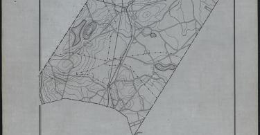
Tewksbury, NJ – A wider angle perspective
Tewksbury Township is a township located in Hunterdon County, New Jersey and is located within the New York Metropolitan Area. As of the 2010 United States Census, the township’s population was 5,993, reflecting an increase of 452 (+8.2%) from the 5,541 counted in the 2000 Census, which had in turn increased by 738 (+15.4%) from the 4,803 counted in the 1990 Census.
The township was first mentioned as holding a township meeting on March 11, 1755, as having been formed partly from Lebanon Township, though the exact circumstances of its formation by charter are unknown. Tewksbury was incorporated as one of New Jersey’s initial 104 townships by an act of the New Jersey Legislature on February 21, 1798. Portions of the township have been taken to form Califon borough (April 2, 1898). Portions of the township were acquired from Readington Township in 1832 and 1861, and portions were transferred to Clinton Township in 1871 and 1891. The township’s name is thought to be from Tewkesbury, England, and the two established a sister city relationship in 2003.
The original settlers were of English extraction. However, a large German contingent settled in the area around 1749 and theirs became the strongest influence when Tewksbury became a township. The enclave of Oldwick, with a mixture of Victorian, Federal, New England and Georgian style homes is protected by historic legislation. Zion Lutheran Church in Oldwick (formerly New Germantown) is the oldest German Lutheran parish in New Jersey.
Oldwick is home to Mane Stream, a Professional Association of Therapeutic Horsemanship (PATH) Premier Accredited Center for therapeutic horseback riding.
Geography
Unincorporated communities, localities and place names located partially or completely within the township include Apgars Corner, Bissell, Cokesbury, Fairmount, Farmersville, Fox Hill, Laurel Farms, Lower Fairmount, Mountainville, New Germantown, Oldwick, Pottersville, Sutton and Vernoy.
Demographics
| Historical population | |||
|---|---|---|---|
| Census | Pop. | %± | |
| 1810 | 1,308 | — | |
| 1820 | 1,490 | 13.9% | |
| 1830 | 1,659 | 11.3% | |
| 1840 | 1,944 | 17.2% | |
| 1850 | 2,301 | 18.4% | |
| 1860 | 2,333 | 1.4% | |
| 1870 | 2,327 | −0.3% | |
| 1880 | 2,108 | −9.4% | |
| 1890 | 2,034 | −3.5% | |
| 1900 | 1,883 | * | −7.4% |
| 1910 | 1,742 | −7.5% | |
| 1920 | 1,279 | −26.6% | |
| 1930 | 1,119 | −12.5% | |
| 1940 | 1,200 | 7.2% | |
| 1950 | 1,439 | 19.9% | |
| 1960 | 1,908 | 32.6% | |
| 1970 | 2,959 | 55.1% | |
| 1980 | 4,094 | 38.4% | |
| 1990 | 4,803 | 17.3% | |
| 2000 | 5,541 | 15.4% | |
| 2010 | 5,993 | 8.2% | |
| Est. 2014 | 5,925 | −1.1% | |
| * = Lost territory in previous decade. | |||
Census 2010
At the 2010 United States Census, there were 5,993 people, 2,189 households, and 1,769 families residing in the township. The population density was 190.1 per square mile (73.4/km). There were 2,323 housing units at an average density of 73.7 per square mile (28.5/km). The racial makeup of the township was 94.16% (5,643) White, 0.83% (50) Black or African American, 0.03% (2) Native American, 2.92% (175) Asian, 0.00% (0) Pacific Islander, 0.82% (49) from other races, and 1.23% (74) from two or more races. Hispanics or Latinos of any race were 3.49% (209) of the population.
There were 2,189 households, of which 34.9% had children under the age of 18 living with them, 73.0% were married couples living together, 5.5% had a female householder with no husband present, and 19.2% were non-families. 15.3% of all households were made up of individuals, and 6.9% had someone living alone who was 65 years of age or older. The average household size was 2.74 and the average family size was 3.05.
In the township, 25.3% of the population were under the age of 18, 4.7% from 18 to 24, 15.2% from 25 to 44, 38.5% from 45 to 64, and 16.3% who were 65 years of age or older. The median age was 47.3 years. For every 100 females there were 97.5 males. For every 100 females age 18 and over, there were 96.7 males.
The Census Bureau’s 2006-2010 American Community Survey showed that (in 2010 inflation-adjusted dollars) median household income was $160,224 (with a margin of error of +/- $13,609) and the median family income was $189,833 (+/- $21,901). Males had a median income of $128,177 (+/- $22,406) versus $90,833 (+/- $32,868) for females. The per capita income for the borough was $91,644 (+/- $13,544). About 0.9% of families and 1.2% of the population were below the poverty line, including 1.3% of those under age 18 and 1.9% of those age 65 or over.
Roads and highways
As of May 2010, the township had a total of 99.22 miles (159.68 km) of roadways, of which 82.81 miles (133.27 km) were maintained by the municipality, 15.39 miles (24.77 km) by Hunterdon County and 1.02 miles (1.64 km) by the New Jersey Department of Transportation.
Interstate 78 passes through the Township and is accessible via Oldwick Road (County Route 523) at Exit 24. County Route 517 also passes through the Township.
Notable people
People who were born in, residents of, or otherwise closely associated with Tewksbury Township include:
- Harriet Adams (1892-1982), juvenile mystery novelist and publisher who authored some 200 books over her literary career, including many books in the Nancy Drew series (under the pseudonym Carolyn Keene) and a few in the Hardy Boys series (under the pseudonym Franklin W. Dixon).
- Joseph Alexander Adams (1803–1880), engraver.
- John Amos (born 1939), actor.
- Pat Calpin, bassist of the ska band Catch 22.
- Nic Chatfield (born 1981), actor and 2nd place winner of 2009 the Doritos “Power of the Crunch” commercial contest chosen to air on Super Bowl XLIII.
- Dan Cocoziello (born 1985), professional lacrosse player.
- Everett Fagan (1918-1983), professional baseball player during the 1940s.
- Eileen Ford (1922-2014), co-founder of Ford Modeling Agency, now called Ford Models.
- Gerard W. Ford (1924–2008), co-founder of Ford Modeling Agency, now called Ford Models.
- James Gandolfini (1961–2013), actor best known for his lead role in the HBO series The Sopranos.
- Alison Haislip (born 1981), actress and correspondent for G4tv‘s Attack of the Show!.
- Andrew Horowitz (born 1983), musician/singer in Tally Hall.
- Brett Jungblut (born 1979), poker player, won an event in 2004 at the World Series of Poker.
- Kamine family, owners of Olympic horse Royal Kaliber.
- Charlie Murphy (born 1959), actor and comedian.
- Pat Pacillo (born 1963), former Major League Baseball pitcher for the Cincinnati Reds.
- Joe Piscopo (born 1951), actor and comedian.
- Webster B. Todd (1899–1989), businessman, Republican leader, and father of Christine Todd Whitman.
- George David Weiss (1921–2010), songwriter and former President of the Songwriters Guild of America.
- Christine Todd Whitman (born 1946), 50th Governor of New Jersey.
- John Whitman (1944-2015), businessman, investment banker and husband of Christine Todd Whitman, who served as First Gentleman of New Jersey.


NJ Route 22 Comment Section