About Princeton, NJ
Princeton, NJ may be the furthest here from NJroute22 – but it’s frequently visited. And a very “historically rich” city in NJ. Or so they say.
Typical routes people in the Route 22 area take to get to Princeton are Route 31 south through Hopewell – or Route 206 south.
Princeton, New Jersey

Princeton, NJ – In case you had no idea where it was.
Princeton is a municipality with a borough form of government in Mercer County, New Jersey, United States, that was established in its current form on January 1, 2013, through the consolidation of the Borough of Princeton and Princeton Township. As of the 2010 United States Census, the municipality’s population was 28,572, reflecting the former township’s population of 16,265, along with the 12,307 in the former borough.
Princeton was founded before the American Revolution and is best known as the location of Princeton University, located in the community since 1756. Although its association with the university is primarily what makes Princeton a college town, other important institutions in the area include the Institute for Advanced Study, Westminster Choir College, Princeton Plasma Physics Laboratory, Princeton Theological Seminary, Opinion Research Corporation, Siemens Corporate Research, SRI International, FMC Corporation, The Robert Wood Johnson Foundation, Amrep, Church and Dwight, Berlitz International, and Dow Jones & Company.
Princeton is roughly equidistant from New York City and Philadelphia. Princeton is close to many major highways that serve both cities and receives major television and radio broadcasts from each.
New Jersey’s capital is the city of Trenton, but the governor’s official residence has been in Princeton since 1945 when Morven in the borough became the first Governor’s mansion. It was later replaced by the larger Drumthwacket, a colonial mansion located in the township. Morven became a museum property of the New Jersey Historical Society.
Princeton was ranked 15th of the top 100 towns in the United States to Live and Work In by some mainstream magazine in 2005.
Although residents of Princeton (Princetonians) traditionally have a strong community-wide identity, the community had been composed of two separate municipalities: a township and a borough. The central borough was completely surrounded by the township. The Borough seceded from the Township in 1894 in a dispute over school taxes; the two municipalities later formed the Princeton Public Schools, and some other public services were conducted together before they were reunited into a single Princeton in January 2013. The Borough contained Nassau Street, the main commercial street, most of the University campus, and incorporated most of the urban area until the postwar suburbanization. The Borough and Township had roughly equal populations.
Early history
The Lenni Lenape Native Americans were the earliest identifiable inhabitants of the Princeton area. Europeans founded their settlement in the latter part of the 17th century. The first European to find his home in the boundaries of the future town was Henry Greenland. He built his house in 1683 along with a tavern. In this drinking hole representatives of West and East Jersey met to set boundaries for the location of the township.
Originally, Princeton was known only as part of nearby Stony Brook. James Leonard first referred to the town as Princetown, when describing the location of his large estate in his diary. The town bore a variety of names subsequently, including Princetown, Prince’s Town and finally Princeton. Although there is no official documentary backing, the town is considered to be named after King William III, Prince William of Orange of the House of Nassau. Another theory suggests that the name came from a large land-owner named Henry Prince, but no evidence backs this contention. A royal prince seems a more likely eponym for the settlement, as three nearby towns had similar names: Kingston, Queenstown (in the vicinity of the intersection of Nassau and Harrison Streets) and Princessville (Lawrence Township).

Nassau Hall, which briefly served as the capital of the United States of America in 1783
When Richard Stockton, one of the founders of the township, died in 1709 he left his estate to his sons, who helped to expand property and the population. Based on the 1880 United States Census, the population of the town comprised 3,209 persons (not including students). Local population has expanded from the nineteenth century. According to the 2010 Census, Princeton Borough had 12,307 inhabitants, while Princeton Township had 16,265. The numbers have become stagnant; since the establishment of Princeton University in 1756, the town’s population spikes every year during the fall and winter and drops significantly over the course of the summer.
Revolution

Battle of Princeton, 1777
Aside from housing the University of the same name, the settlement suffered the revolutionary Battle of Princeton on its soil. After the victory in 1777, the town hosted the first Legislature under the State Constitution of New Jersey to decide the State’s seal, Governor, and organization of its government. In addition, two of the original signers of the Declaration of Independence—Richard Stockton and John Witherspoon lived in Princeton. Princetonians honored their citizens’ legacy by naming two streets in the downtown area after them.
On January 10, 1938, Henry Ewing Hale called for a group of citizens to discuss opening a “Historical Society of Princeton.” Later the Bainbridge House would be dedicated for this purpose. Previously the house was used once for a meeting of Continental Congress in 1783, a general office and as the Princeton Public Library. The House is actually the property of Princeton University and is leased to the Princeton Historical Society for one dollar per year. The house has kept its original staircase, flooring and paneled walls. Altogether, 70% of the house has been unaltered. Aside from safety features like wheelchair access and electrical work, the house was merely restored to its original look.
Government history
During the most stirring events in its history, Princeton was a wide spot in the road; the boundary between Somerset County and Middlesex County ran right through Princeton, along the high road between New York and Philadelphia, now Nassau Street. When Mercer County was formed in 1838, part of West Windsor Township was added to the portion of Montgomery Township which was included in the new county, and made into Princeton Township; the area between the present borough line and the Delaware and Raritan Canal was added to Princeton Township in 1853. Princeton Borough became a separate municipality in 1894.
In the early nineteenth century, New Jersey boroughs had been parish bodies, chartered within existing townships. Princeton Borough received such a charter in 1813, as part of Montgomery and West Windsor Townships; it continued to be part of Princeton Township until the Act of 1894, which required that each township form a single school district; rather than do so, Princeton Borough petitioned to be separated. (The two Princetons now form the Princeton Public Schools.) Two minor boundary changes united the then site of the Princeton Hospital and of the Princeton Regional High School inside the Borough, in 1928 and 1951 respectively.
Geography
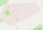
According to the United States Census Bureau, Princeton has a total area of 18.363 square miles (68.041 km), including 17.932 square miles (46.444 km) of land (97.65%) and 0.431 square miles (1.115 km) of water (2.35%).
Cedar Grove, Port Mercer, North Princeton, Princeton Basin, and Jugtown are unincorporated communities that have been absorbed into Greater Princeton over the years, but still maintain their own community identity.
The borough borders Hopewell Township, Lawrence and West Windsor Townships in Mercer County; Plainsboro Township and South Brunswick Township in Middlesex County; and Franklin Township and Montgomery Township in Somerset County.
United States Postal ZIP codes for Princeton include 08540, 08541 (Educational Testing Service), 08542 (largely the old Borough), 08543 (PO boxes), and 08544 (the University).
Demographics
| Historical population | |||
|---|---|---|---|
| Census | Pop. | %± | |
| 2010 | 28,572 | — | |
| Est. 2014 | 30,108 | 5.4% | |
As of the 2010 United States Census, the borough and township had a combined population of 28,572.
Roads and highways
As of May 2010, the borough had a total of 126.95 miles (204.31 km) of roadways, of which 118.36 miles (190.48 km) were maintained by the municipality, 3.93 miles (6.32 km) by Mercer County, and 8.66 miles (13.94 km) by the New Jersey Department of Transportation.
U.S. Route 206 and New Jersey Route 27 pass through Princeton, along with County Routes 583, 571 (commonly known as Washington Road) and 533.
Other major roads that are accessible outside the municipality include U.S. Route 1 (in Lawrence, West Windsor & South Brunswick), Interstate 95 (the section north of Trenton) and Interstate 295 (both in Lawrence), and the New Jersey Turnpike (also designated as Interstate 95, east of Trenton). The closest Turnpike exits are Exit 8A in Monroe Township, Exit 8 in East Windsor, and Exit 7A in Robbinsville.
A number of proposed highways around Princeton have been canceled. The Somerset Freeway (Interstate 95) was to pass just outside the municipality before ending in Hopewell (to the south) and Franklin (to the north). This project was canceled in 1980. Route 92 was supposed to remedy the lack of limited-access highways to the greater Princeton area. The road would have started at Route 1 near Ridge Road in South Brunswick and ended at Exit 8A of the Turnpike. However, that project was killed in 2006.
Public transportation
The “Dinky” at the Princeton Branch platform at Princeton Junction.
Princeton is roughly equidistant from New York City and Philadelphia. Since the 19th century, it has been connected by rail to both of these cities by the Princeton Branch rail line to the nearby Princeton Junction Station on Amtrak‘s Northeast Corridor. The Princeton train station was moved from under Blair Hall to a more southerly location on University Place in 1918, and was moved further southeast in 2013. Commuting to New York from Princeton became commonplace after the Second World War. While the Amtrak ride time is similar to New York and to Philadelphia, the commuter-train ride to New York — via New Jersey Transit‘s Northeast Corridor Line — is generally much faster than the equivalent train ride to Philadelphia, which involves a transfer to SEPTA trains in Trenton. New Jersey Transit provides shuttle service between the Princeton and Princeton Junction stations; the train is locally called the “Dinky”, and has also been known as the “PJ&B” (for “Princeton Junction and Back”). Two train cars, or sometimes just one, are used.
NJ Transit provides bus service to Trenton on the 606 route and local service on routes 605 and 655. Coach USA Suburban Transit operates frequent daily service to midtown NYC on the 100 route, and weekday rush-hour service to downtown NYC on the 600 route. Princeton and Princeton University provide the FreeB and Tiger Transit local bus services.
Air
Princeton Airport is a public airport lying 3 miles (5 km) north of Downtown Princeton in Montgomery Township. The private Forrestal Airport was located on Princeton University property, 2 miles (3 km) east of the main campus, from the early 1950s through the early 1990s.
The closest commercial airport is Trenton-Mercer Airport in Ewing Township, about 15 miles (24 km) from the center of Princeton, which is served by Frontier Airlines nonstop to and from 17 points nationwide. Other nearby major airports are Newark Liberty International Airport and Philadelphia International Airport, located 39 miles (63 km) and 52 miles (84 km) away, respectively.
Notable people
People who were born in, residents of, or otherwise closely associated with Princeton include:
- Matthew Abelson, hammered dulcimer player.
- George Akerlof (born 1940), economist who shared the 2001 Nobel Memorial Prize in Economic Sciences.
- Archibald Alexander (1772-1851), Presbyterian theologian and first professor at the Princeton Theological Seminary.
- Joseph Addison Alexander (1809-1860), biblical scholar.
- James Waddel Alexander (1804-1859), Presbyterian minister and theologian.
- Svetlana Alliluyeva (1926–2011), daughter of Joseph Stalin, defected to United States and lived in Princeton
- Lylah M. Alphonse (born 1972), journalist.
- Saul Amarel (1928-2002), professor of computer science at Rutgers University, and best known for his pioneering work in artificial intelligence.
- Trey Anastasio (born 1964), of the band Phish, lived in Princeton with his family and attended Princeton Day School.
- Milton Babbitt (1916–2011), composer and Princeton University professor.
- Molly Bang (born 1943), children’s book illustrator, born in Princeton.
- Chris Barron, lead singer of the Spin Doctors.
- Saul Bellow (1915–2005), author and Princeton University professor.
- Paul Benacerraf (born 1931), philosopher and Princeton University professor.
- Peter Benchley (1940–2006), author and screenwriter, Jaws, The Island, lived and died in Princeton.
- Ben Bernanke (born 1953), former Chairman of the Board of Governors of the United States Federal Reserve, Princeton University professor.
- Garrett Birkhoff (1911-1996), mathematician best known for his work in lattice theory.
- Michael Bradley (born 1987), soccer player.
- Avery Brooks (born 1948), actor, singer and educator.
- George Harold Brown (1908–1987), research engineer at RCA, lived in Princeton.
- Aaron Burr (1756–1836), third Vice President of the United States (under Thomas Jefferson); killed Alexander Hamilton in duel, grew up in Princeton and is buried there.
- Aaron Burr, Sr. (1715–1757), co-founder of Princeton University and its second president.
- Sim Cain (born 1963), drummer for Rollins Band, grew up in Princeton.
- Mary Chapin Carpenter (born 1958), country/folk singer, born and grew up in Princeton.
- William Ashburner Cattell (1863–1920), civil engineer and railroad company president; born in Princeton.
- Patrick Clark (1955–1998), chef.
- Frances Folsom Cleveland (1864–1947), First Lady, died in and buried in Princeton.
- Grover Cleveland (1837–1908), 22nd and 24th President of the United States, retired to, died in, and buried in Princeton.
- Ruth Cleveland (1891–1904), daughter of Grover and Frances Cleveland born between Cleveland’s two terms in office, who died at age 12 and is buried at Princeton Cemetery.
- Chris Conley (born 1980), lead singer of Saves the Day, born and grew up in Princeton.
- Whitney Darrow, Jr. (1909–1999), New Yorker cartoonist, born in Princeton.
- Freeman Dyson (born 1923), theoretical physicist and fellow at the Institute for Advanced Study.
- Jonathan Edwards (1703–1758), Congregationalist Church theologian and Princeton University’s third president.
- Albert Einstein (1879–1955), physicist, fellow at the Institute for Advanced Study.
- T. S. Eliot (1888–1965), author.
- Elmer William Engstrom (1901–1984), President and CEO of RCA.
- Charles Evered (born 1964), playwright, screenwriter and director, resident of Princeton.
- Henry B. Eyring (born 1933), First Counselor in the First Presidency of The Church of Jesus Christ of Latter-day Saints and president of Ricks College, born in Princeton.
- Robert Fagles (1933-2008), professor, poet, and academic, best known for his many translations of ancient Greek and Roman classics, especially his translations of the epic poems of Homer.
- Abner S. Flagg (1851-1923), businessman and politicians who served in the Wisconsin State Assembly and as Mayor of Edgerton, Wisconsin.
- Richard Ford (born 1944), writer, taught at Princeton University and has written several books set in a fictionalized Haddam, New Jersey, based in part on Princeton.
- George Gallup (1901–1984), statistician and creator of the Gallup poll, lived and is buried in Princeton
- George Gallup, Jr. (1930–2011), pollster and author
- Kurt Gödel (1906–1978), Austrian-American logician, mathematician and philosopher, fellow at the Institute for Advanced Study
- Michael Graves (1934-2015), architect, lived and worked in Princeton
- Ethan Hawke (born 1970), actor
- Sarah Hay, (born 1986/87), actress and ballet dancer with the Semperoper in Dresden.
- Joseph Hewes (1730–1779), signer of the United States Declaration of Independence, born in Princeton
- Charles Hodge (1797–1878), theologian and Principal of Princeton Theological Seminary
- Herbert Huffman (1905–1968), musician and choir director, founder of the American Boychoir School
- Robert Wood Johnson II (1893–1968), Chairman of Johnson & Johnson, and his wife Basia Johnson, lived in Morven
- George F. Kennan (1904–2005), diplomat, historian, fellow at the Institute for Advanced Study
- Gina Kolata (born 1948), reporter for The New York Times
- Paul Krugman (born 1953), Nobel Prize winner, economist, professor of economics and international affairs at Princeton University.
- Matt Lalli (born 1986), professional lacrosse player for the Boston Cannons of Major League Lacrosse.
- Chang-Rae Lee (born 1965), writer, Princeton University professor
- Arthur Lithgow (1915–2004), actor, director, educator, and managing director of Princeton’s McCarter Theatre
- John Lithgow (1945), actor, lived in Princeton in his late teens
- Emily Mann (born 1952), artistic director of Princeton’s McCarter Theatre
- Thomas Mann (1875–1955), author
- Henry Martin, cartoonist at New Yorker who lived and worked in Princeton.
- Brad Mays (born 1955), filmmaker and stage director, grew up in Princeton and attended Princeton High School
- John McPhee (born 1931), writer, lives in Princeton.
- Rachel Lambert Mellon (1910-2014), horticulturalist, gardener, philanthropist and art collector.
- Steve “Buddy” Miller (1952), Nashville session musician, grew up in Princeton and attended Princeton High School.
- Toni Morrison (born 1931), author, Nobel Laureate, Princeton University professor.
- Paul Muldoon (born 1951), Irish poet.
- John Forbes Nash, Jr. (1928-2015), mathematician, Nobel Prize winner, subject of A Beautiful Mind, Princeton University professor.
- John von Neumann (1903−1957), Hungarian-American mathematician at Princeton University and Institute for Advanced Study
- Bebe Neuwirth (born 1958), actress, grew up in Princeton.
- Joyce Carol Oates (born 1938), writer, Princeton University professor.
- John O’Hara (1905–1970), author, lived and is buried in Princeton.
- Charles Smith Olden (1799–1876), Governor of New Jersey during the American Civil War.
- Gregory Olsen (born 1945), entrepreneur, engineer and scientist who, in October 2005, became the third private citizen to make a self-funded trip to the International Space Station
- J. Robert Oppenheimer (1904–1967), theoretical physicist, director of the Institute for Advanced Study.
- Barbara Piasecka Johnson (1937–2013), Polish-born American humanitarian, philanthropist, art connoisseur and collector.
- John Popper (born 1967), lead singer of the band Blues Traveler.
- Christopher Reeve (1952–2004), actor, grew up in Princeton, attended Princeton Day School.
- Paul Robeson (1898–1976), singer, actor, athlete, civil rights activist, born and raised in Princeton.
- Arnold Roth (born 1929), cartoonist, was a longtime Princeton resident.
- Ralph Schoenstein (1933-2006), writer, lived in Princeton up to his death.
- Bill Schroeder (born 1958), Major League Baseball player for the Milwaukee Brewers and California Angels, Brewers commentator for Fox Sports Wisconsin.
- Roger Sessions (1896-1985), composer, Princeton University professor, died in Princeton.
- Andrew Shue (born 1967), actor and professional soccer player, grew up in northern New Jersey with sister, actress Elisabeth Shue, lives in Princeton.
- Michael Showalter (born 1970), comedian, actor, writer, and director, born in Princeton, attended Princeton High School.
- Barbara Boggs Sigmund (1939-1990), mayor of Princeton.
- Peter Singer (born 1946), moral philosopher, bioethicist and Princeton University professor.
- Shelley Smith (born 1952), actress.
- Tom Snow (born 1947), musician.
- Gennady Spirin (born 1948), artist.
- Betsey Stockton (c. 1798–1865), educator and missionary, manumitted from slavery and later retired to and died in Princeton.
- John P. Stockton (1826–1900), U.S. Senator from New Jersey, lived in Princeton.
- Richard Stockton (1730–1781), signer of the United States Declaration of Independence, lived in Princeton, buried in Princeton.
- Richard Stockton (1764–1828), U.S. Senator from New Jersey, lived in Princeton.
- Robert F. Stockton (1795–1866), United States Navy commodore, U.S. Military Governor of California, lived in Princeton.
- Jon Tenney (born 1961), actor, born and grew up in Princeton.
- Paul Tulane (1801–1887), benefactor and namesake of Tulane University.
- Immanuel Velikovsky (1895–1979), controversial theorist and acquaintance of Albert Einstein.
- Andrew Wiles (born 1953), mathematician who proved Fermat’s Last Theorem, Princeton University professor.
- Woodrow Wilson (1856–1924), 28th President of the United States, 13th president of Princeton University and Governor of New Jersey.
- John Witherspoon (1723–1794), signer of the United States Declaration of Independence, president of Princeton University.
- Edward Witten (born 1951), mathematician and physicist, fellow at the Institute for Advanced Study.
- Richard L. Wright (born 1943), political leader who held a number of positions at both the state and national level.
- Sarah Zelenka (born 1987), rower at the 2012 Summer Olympics.
- Vladimir K. Zworykin (1888–1982), Russian-American engineer, inventor and television pioneer.