
About Springfield, NJ
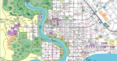
Springfield, NJ may very well be a nice place to live! But there’s a 2 1/2 mile stretch of NJ Route 22 into Union that is considered “infamous.” A split retail frenzy with stores in-between the eastbound and westbound lanes. Definitely requires skill and good luck not to screw your ride up in that section.
Anyway – what “diamonds in the rough” does anyone recommend in Springfield, NJ?
Here is the “encyclopedia” entry:
Springfield Township, Union County, New Jersey
Springfield Township is a township in Union County, New Jersey, United States. As of the 2010 United States Census, the township’s population was 15,817, the highest recorded at any decennial census, reflecting an increase of 1,388 (+9.6%) from the 14,429 counted in the 2000 Census, which had in turn increased by 1,009 (+7.5%) from the 13,420 counted in the 1990 Census. Recent housing construction has pushed the township’s population to 17,193 as of the 2014 census estimate.
Springfield was formed as a township on April 14, 1794, from portions of Elizabeth Township and Newark Township, while the area was still part of Essex County, and was incorporated as one of New Jersey’s first 104 townships by an act of the New Jersey Legislature on February 21, 1798. It became part of the newly formed Union County on March 19, 1857, with portions remaining in Essex County used to create Millburn. Other portions of the township have been taken to form New Providence Township (November 8, 1809, now known as Berkeley Heights), Livingston (February 5, 1813), Summit (March 23, 1869) and Cranford (March 14, 1871). The township’s name derives from springs and brooks in the area.
The Battle of Springfield was fought here, the last of many battles of the American Revolutionary War to be fought in New Jersey.
Geography
According to the United States Census Bureau, the township had a total area of 5.193 square miles (13.449 km), including 5.174 square miles (13.400 km) of land and 0.019 square miles (0.049 km) of water (0.37%).
The Township of Springfield is located on the northern edge of Union County and is bordered by Millburn to the north in Essex County, by Union Township to the east, by Kenilworth to the southeast, by Westfield and Cranford to the south, by Mountainside to the southwest and by Summit to the northwest.
Unincorporated communities, localities and place names located partially or completely within the township include Baltusrol, Branch Mills and Milltown.
Demographics
| Historical population | |||
|---|---|---|---|
| Census | Pop. | %± | |
| 1810 | 2,360 | — | |
| 1820 | 1,804 | * | −23.6% |
| 1830 | 1,656 | −8.2% | |
| 1840 | 1,651 | −0.3% | |
| 1850 | 1,945 | 17.8% | |
| 1860 | 1,020 | * | −47.6% |
| 1870 | 770 | * | −24.5% |
| 1880 | 844 | * | 9.6% |
| 1890 | 959 | 13.6% | |
| 1900 | 1,073 | 11.9% | |
| 1910 | 1,246 | 16.1% | |
| 1920 | 1,715 | 37.6% | |
| 1930 | 3,725 | 117.2% | |
| 1940 | 4,148 | 11.4% | |
| 1950 | 7,214 | 73.9% | |
| 1960 | 14,467 | 100.5% | |
| 1970 | 15,740 | 8.8% | |
| 1980 | 13,955 | −11.3% | |
| 1990 | 13,420 | −3.8% | |
| 2000 | 14,429 | 7.5% | |
| 2010 | 15,817 | 9.6% | |
| Est. 2014 | 17,193 | 8.7% | |
| * = Lost territory in previous decade. | |||
2010 Census
At the 2010 United States Census, there were 15,817 people, 6,511 households, and 4,265 families residing in the township. The population density was 3,057.2 per square mile (1,180.4/km). There were 6,736 housing units at an average density of 1,302.0 per square mile (502.7/km). The racial makeup of the township was 82.46% (13,042) White, 6.25% (989) Black or African American, 0.06% (10) Native American, 7.70% (1,218) Asian, 0.01% (2) Pacific Islander, 1.75% (277) from other races, and 1.76% (279) from two or more races. Hispanics or Latinos of any race were 9.50% (1,502) of the population.
There were 6,511 households, of which 29.0% had children under the age of 18 living with them, 53.6% were married couples living together, 8.9% had a female householder with no husband present, and 34.5% were non-families. 29.6% of all households were made up of individuals, and 14.0% had someone living alone who was 65 years of age or older. The average household size was 2.43 and the average family size was 3.05.
In the township, 21.1% of the population were under the age of 18, 5.7% from 18 to 24, 26.4% from 25 to 44, 29.3% from 45 to 64, and 17.5% who were 65 years of age or older. The median age was 42.9 years. For every 100 females there were 88.8 males. For every 100 females age 18 and over, there were 84.7 males.
The Census Bureau’s 2006-2010 American Community Survey showed that (in 2010 inflation-adjusted dollars) median household income was $84,038 (with a margin of error of +/- $8,139) and the median family income was $111,359 (+/- $8,121). Males had a median income of $74,335 (+/- $7,959) versus $62,859 (+/- $6,250) for females. The per capita income for the township was $46,393 (+/- $3,175). About 2.9% of families and 6.0% of the population were below the poverty line, including 1.9% of those under age 18 and 5.6% of those age 65 or over.
Transportation
Roads and highways
As of May 2010, the township had a total of 56.53 miles (90.98 km) of roadways, of which 39.82 miles (64.08 km) were maintained by the municipality, 8.63 miles (13.89 km) by Union County and 8.08 miles (13.00 km) by the New Jersey Department of Transportation.
A number of major highways and roadways pass through Springfield, including Interstate 78, U.S. Route 22, NJ Routes 24 and 124, as well as CR 509 Spur and CR 577.
Public transportation
New Jersey Transit provides bus service to the Port Authority Bus Terminal in Midtown Manhattan in New York City and to points in New Jersey including Newark Penn Station. Parking is available for a fee at a municipal lot near the center of town (Hannah Street and Center Street) and in the Duffy’s Corner lot at Morris and Caldwell Place, which provide easy access to all NJ Transit buses that run through town. Annual permits are available from the town hall.
Although there is no train station in Springfield, the Millburn and Short Hills NJ Transit stations are located nearby, though neither allows commuter-hour parking for non-residents, and parking hours are very limited even on weekends. The closest stations that allow out-of-town residents access to parking are Maplewood and Summit, although both are full to capacity very early on weekdays. The 70 bus provides access from the center of town to NJ Transit’s Summit and Millburn stations; Eastbound it terminates at NJ Transit’s Newark Penn Station with connections to Amtrak, NJ Transit trains to New York Penn Station, and Port Authority Trans-Hudson (PATH) trains. The township also runs a jitney that operates on weekdays during morning and evening rush hours from the community pool to NJ Transit’s Short Hills station. NJ Transit buses 65, 66 and 70 (to Newark), the 114 (to Midtown Manhattan’s Port Authority Bus Terminal) and local service on the 52 route also run along the town’s major roadways.
Newark Liberty International Airport is approximately 10 miles (16 km) east of Springfield.
Historical transportation
The Rahway Valley Railroad passed through the community, and during the early 20th Century offered both freight and passenger service, but is currently out of service. The section of the railway that extended from Springfield to Summit was taken out of service in 1976, though special trains were operated to provide service to Baltusrol during the 1980 U.S. Open.
A trolley line called the Morris County Traction Company, ran trolley service through Springfield to/from Newark and Morris County, in the early part of the 20th Century.
Notable people
People who were born in, residents of, or otherwise closely associated with Springfield Township include:
- Lou Campanelli, basketball coach.
- Jonas Coe (1805-1864), naval commander in Argentina and Uruguay.
- Jon Denning (born 1987), NASCAR driver.
- Jeannette DePalma (1956-1972), murder victim whose unsolved case has become a matter of significant controversy thanks in part to coverage in Weird NJ magazine.
- George A. Halsey (1827–1894), politician who represented New Jersey’s 5th congressional district in Congress from 1867 to 1869 and from 1871 to 1873.
- Toni Kalem (born 1951), actress, screenwriter and director best known for her portrayal of Angie Bonpensiero on the HBO series, The Sopranos.
- Louis Keller (1857-1922), publisher, social arbiter of high society and golf club owner, best known as the founder of the Baltusrol Golf Club and as the first publisher of the Social Register.
- Donald Lan (born 1930), politician who served as Secretary of State of New Jersey from 1977 to 1982.
- George Low Jr. (1912-1995), professional golfer who was better known as a putting instructor and hustler than as a golfer.
- George Low Sr. (1874-1950), Scottish-American professional golfer who finished tied for second place in the 1899 U.S. Open championship.
- Dina Matos (born 1966), former First Lady of New Jersey.
- Gail J. McGovern, (born 1952), businessperson who has served as President and CEO of the American Red Cross.
- Mark Melni, pianist and inventor.
- Dylan O’Brien (born 1991), actor.
- Harry Pappas, politician who served on the Springfield Township Committee, has held posts in the Democratic and Republican parties in New Jersey and is a perennial candidate for public office.
- Bernard Purdie (born 1941), prolific session drummer.
- Claudio Reyna (born 1973), professional soccer player.
- Jeff Ross (born 1965 as Jeffrey Ross Lifschultz), comedian.
- George Erik Rupp (born 1942), former President of Rice University and Columbia University, who has headed the International Rescue Committee since 2002.
- Gabe Saporta (born 1979), lead singer and primary creative force behind the band Cobra Starship.
- Joe Schaffernoth (born 1937), pitcher who played for the Chicago Cubs and Cleveland Indians.
- Zygi Wilf (born 1950), owner of the Minnesota Vikings.
- James Yee (born c. 1968), former United States Army chaplain with the rank of captain who is best known for being subject to an intense investigation by the United States, but all charges were later dropped.
(SOURCE: Infogalactic)


 Fast Food")


NJ Route 22 Comment Section