About Bethlehem, PA
Bethlehem, PA is interesting. They have legal gambling, as well as a fun annual art festival. Just a fascinating place to visit (more so if you’re from NJ and have never been. It’s an adventure!)
Intersecting with both Route 22 and Route 78, Bethlehem has us covered for lots of things.
We’ll touch on this compelling destination at least a couple times a year.
Bethlehem, Pennsylvania

In case you were not paying attention in geography class in high school.
Bethlehem is a city in Lehigh and Northampton counties in the Lehigh Valley region of the eastern portion of the U.S. state of Pennsylvania. As of the 2010 census, the city had a total population of 74,982, making it the seventh largest city in Pennsylvania, after Philadelphia, Pittsburgh, Allentown, Erie, Reading, and Scranton. Of this, 55,639 were in Northampton County, and 19,343 were in Lehigh County.
Bethlehem lies in the center of the Lehigh Valley, a region of 731 square miles (1,893 km²) that is home to more than 800,000 people. Together with Allentown and Easton, the Valley embraces the Allentown-Bethlehem-Easton, PA-NJ metropolitan area, including Lehigh, Northampton, and Carbon counties within Pennsylvania, and Warren County in the adjacent state of New Jersey. Smaller than Allentown but larger than Easton, Bethlehem is the Lehigh Valley’s second most populous city. In turn, this metropolitan area comprises Pennsylvania’s third-largest metropolitan area and the state’s largest and most populous contribution to the greater New York City metropolitan area.
There are four general sections of the city: central Bethlehem, the south side, the east side, and the west side. Each of these sections blossomed at different times in the city’s development and each contains areas recognized under the National Register of Historic Places. Zip codes that use the address Bethlehem totaled 116,000 in population in the year 2000. These zip codes include Bethlehem Township and Hanover Township.
In July 2006, some news-rag placed Bethlehem as number 88 on its “Top 100 Best Places to Live.” They publish various lists annually, and the rankings change each year. Ever wonder why?
History
The areas along the Delaware River and its tributaries in eastern Pennsylvania were long inhabited by indigenous peoples of various cultures. By the time of European contact, these areas were the historic territory of the Algonquian-speaking Lenape Nation, which had three main divisions, the Unami, Unalachtigo, and Munsee. They traded with the Dutch and then English colonists in the mid-Atlantic area.
On Christmas Eve in 1741, David Nitschmann and Count Nicolaus von Zinzendorf, leading a small group of Moravians, founded the mission community of Bethlehem along the banks of the Monocacy Creek by the Lehigh River in the colony of Pennsylvania. They came to set up missionary communities among the Native Americans and unchurched German-speaking Christians. They named the settlement after the Biblical town Bethlehem of Judea, the birthplace of Jesus. “Count Zinzendorf said, ‘Brothers, how more fittingly could we call our new home than to name it in honor of the spot where the event we now commemorate took place. We will call this place Bethlehem.’ And so was Bethlehem named after the birthplace of the Man of Peace.'” (from a letter by Gordon Dent to Mr. T. Donald Bain March 3, 1965 quoting from “Story of Bethlehem Steel” by Arundel Cotter, more details are given in this article) Originally it was a typical Moravian Settlement Congregation, where the Church owned all the property. Until the 1850s, only members of the Moravian Church were permitted to lease land plots in Bethlehem. The historic Brethren’s House, Sisters’ House, Widows’ House and Gemeinhaus (Congregation House) with the Old Chapel are remnants of this period of communal living.
The Moravians ministered to regional Lenape Native Americans through their mission in the area, as well as further east in the New York colony. In the historic Bethlehem God’s Acre cemetery, converted Lenape lie buried alongside the Moravians.
In 1762, Bethlehem built the first water-works in America to pump water for public use. While George Washington and his troops stayed in Valley Forge, Washington stored his personal effects at the farm of James Burnside in Bethlehem – as of 1998 a historical museum (Burnside Plantation).
The prosperous village was incorporated into a free borough in the County of Northampton in 1845. After the Unity Synod of 1848, Bethlehem became the headquarters of the Northern Province of the Moravian Church in North America.
On March 27, 1900, the Bach Choir of Bethlehem presented the United States debut of German Lutheran Johann Sebastian Bach‘s Mass in B Minor in the city’s Central Moravian Church.
Boroughs merge
After the Civil War, the Borough of South Bethlehem was formed. In 1886 the Borough of West Bethlehem (in Lehigh County) was formed. In 1904, the Boroughs of West Bethlehem (in Lehigh County) and Bethlehem (in Northampton County) merged. In 1917, the Borough of South Bethlehem and Bethlehem merged to become the City of Bethlehem, with Archibald Johnston (1865-1948) selected as the new city’s first mayor. Bethlehem Township, Pennsylvania has remained a separate political entity. Even after the merger of the two boroughs, the bureau initially provided a count for the original sections.
| Census | All Three boroughs |
South Bethlehem |
Original Bethlehem |
West Bethlehem |
Bethlehem & West Bethlehem |
Bethlehem Township |
|---|---|---|---|---|---|---|
| 1850 | —– | 1,516 | —– | —– | ||
| 1860 | —– | 2,868 | —– | —– | ||
| 1870 | 3,556 | 4,512 | —– | 2,230 | ||
| 1880 | 4,925 | 5,193 | —– | 2,282 | ||
| 1890 | 19,823 | 10,302 | 6,762 | 2,759 | 9,521 | 2,397 |
| 1900 | 23,999 | 13,241 | 7,293 | 3,465 | 10,758 | 3,090 |
| 1910 | 32,810 | 19,973 | 8,365 | 4,472 | 12,837 | 3,414 |
Bethlehem Steel
Bethlehem Steel began producing the first wide-flange structural shapes made in the United States and they pioneered the production of the now-ubiquitous “I-beam” used in construction of steel-framed buildings, including skyscrapers. It manufactured construction materials for numerous New York and other city skyscrapers, as well as for major bridges.
The company became a major supplier of armor plate and ordnance products during World War I and World War II, including the manufacture of 1,100 warships. After roughly 140 years of metal production at its Bethlehem plant, Bethlehem Steel ceased operations there in 1995, in the face of overseas competition and declining demand.
Geography
According to the United States Census Bureau, the city has a total area of 19.4 square miles (50 km), of which, 19.3 square miles (50 km) of it is land and 0.2 square miles (0.52 km) of it (0.88%) is water.
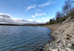
Because large volumes of water were required in the steelmaking process, the city purchased 22,000 acres (8,900 ha) of land in the Pocono Mountains, where its water is stored in reservoirs.
Bethlehem is about 50 miles (80 km) north of Philadelphia and about 80 miles (130 km) west of New York City.
Neighborhoods

South Bethlehem in 1935, looking north to houses and Bethlehem Steel
- Center City is bounded by the Monocacy Creek to the west, Hanover and Bethlehem townships (both Northampton County) to the north, and Stefko Boulevard to the east.
- The West Side begins at the city’s western border with Allentown and continues east to the Monocacy Creek and north to Hanover Township (Lehigh County).
- The Mount Airy Neighborhood is bounded by Pennsylvania Ave to the west, W. Broad St to the north, 2nd Ave to the east and the Lehigh River to the south.
- The East Side is bordered to the west by Center City and to the east by Bethlehem Township and Freemansburg. The East Side includes the Pembroke Village area.
- The South Side’s borders are Fountain Hill to the west, the Lehigh River to the north, South Mountain to the south, and Hellertown to the east.
Demographics
| Historical population | |||
|---|---|---|---|
| Census | Pop. | %± | |
| 1850 | 1,516 | — | |
| 1860 | 2,866 | 89.1% | |
| 1870 | 4,512 | 57.4% | |
| 1880 | 5,193 | 15.1% | |
| 1890 | 6,762 | 30.2% | |
| 1900 | 7,293 | 7.9% | |
| 1910 | 12,837 | 76.0% | |
| 1920 | 50,358 | 292.3% | |
| 1930 | 57,892 | 15.0% | |
| 1940 | 58,490 | 1.0% | |
| 1950 | 66,340 | 13.4% | |
| 1960 | 75,408 | 13.7% | |
| 1970 | 72,686 | −3.6% | |
| 1980 | 70,419 | −3.1% | |
| 1990 | 71,428 | 1.4% | |
| 2000 | 71,329 | −0.1% | |
| 2010 | 74,982 | 5.1% | |
| Est. 2014 | 75,135 | 0.2% | |
As of the census of 2010, there were 74,982 people residing in the city. There were 31,221 housing units, with 5.9% vacant. The racial makeup of the city was 76.4% White, 6.9% African American, 0.3% Native American, 2.9% Asian, 0.0% Pacific Islander, 10.0% from other races, and 3.4% from two or more races. Hispanic or Latino of any race were 24.4% of the population.
As of the census of 2000, there were 71,329 people residing in the city, including 17,094 families and 28,116 households. The population density was 3,704.4 people per square mile (1,429.9/km²). There were 29,631 housing units at an average density of 1,538.8 per square mile (594.0/km²). The racial makeup of the city was 81.85% White, 3.64% African American, 0.26% Native American, 2.22% Asian, 0.03% Pacific Islander, 9.44% from other races, and 2.56% from two or more races. Hispanic or Latino of any race were 18.23% of the population. There were 28,116 households, out of which 26.3% had children under the age of 18 living with them, 44.1% were married couples living together, 12.8% had a female householder with no husband present, and 39.2% were non-families. 32.3% of all households were made up of individuals, and 14.4% had someone living alone who was 65 years of age or older. The average household size was 2.34 and the average family size was 2.95.
In the city, the population was spread out, with 21.0% under the age of 18, 14.4% from 18 to 24, 26.6% from 25 to 44, 20.1% from 45 to 64, and 17.9% who were 65 years of age or older. The median age was 36 years. For every 100 females there were 91.5 males. For every 100 females age 18 and over, there were 88.6 males.
The median income for a household in the city was $35,815, and the median income for a family was $45,354. Males had a median income of $35,190 versus $25,817 for females. The per capita income for the city was $18,987. About 11.1% of families and 15.0% of the population were below the poverty line, including 20.7% of those under age 18 and 8.8% of those age 65 or over.
The city is served by Lehigh Valley International Airport, which also serves Allentown, Pennsylvania and the greater Lehigh Valley.
Economy
In December 2006, Las Vegas Sands Corp was awarded a Category 2 Slot Machine License by the Pennsylvania Gaming Control Board. LVSC began work on the site, categorized as both the largest brownfield redevelopment project in the nation and the largest casino development investment made to date in the Commonwealth. Its mission was to create reinvestment and urbanization in the area. At a projected cost of $743 million, the historic Bethlehem Steel plant is being redeveloped as a fully integrated resort, to include 3,000 slot machines, over 300 hotel rooms, 9 restaurants, 200,000 square feet (19,000 m) of retail outlet shopping, and 46,000 square feet (4,300 m) of flexible multi-purpose space. In 2007, the casino resort company of Las Vegas Sands began the construction of Sands Casino Resort Bethlehem. The Sands Casino has been projected to bring in approximately one million dollars in revenue per day as of 2009.
Another major economic anchor to the city is St. Luke’s Hospital located in neighboring Fountain Hill. That Hospital and Health Network is the second largest of its type in the Lehigh Valley. Other major employers include B. Braun, Lehigh University, and the Guardian Life Insurance Company of America.
Other companies in Bethlehem include the candy company Just Born.
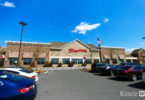
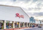
Shopping
The city has also experienced many new shops opening along Main Street Downtown and along E. Third Street on the South Side. Several years ago, W. Broad Street between N. New Street and Guetter Street was an outdoor pedestrian mall, similar to the former Hamilton Mall in Allentown. Like the Hamilton Mall, the pedestrian mall was torn up and made into W. Broad Street. Adjacent to W. Broad Street is the Bethlehem Plaza Mall, a 90,000 square feet (8,400 m) enclosed shopping mall.
Outside of Downtown, there are several other shopping centers.
- Westgate Mall is an enclosed mall with anchors The Bon-Ton and Weis Markets.
- Lehigh Center Shopping Center has Marshalls/HomeGoods, Staples, Giant, and Big Lots.
- Martin Court Shopping Center has Lowe’s and PriceRite.
- Stefko Boulevard Shopping Center has Valley Farm Market, Dollar Tree, Via Thrift Store, Wine and Spirits, J’s Steaks and Subs, and The Meadows Frozen Custard.
- Bethlehem Square is a shopping center with Giant, TJMaxx, Wal-Mart, and The Home Depot.
Recreation and entertainment
The city is famous for its annual Musikfest, a largely free, ten-day music festival that draws over a million people to the city each August. Other festivals include The Celtic Classic, which celebrates Celtic culture, food and music, and the SouthSide Film Festival, a non-competitive, not-for-profit film festival. The city has also been the past, and current host of the North East Art Rock Festival, or NEARFest, a popular 3-day Progressive rock music event.
The Bethlehem Area Public Library is a popular destination for recreation and entertainment. The Banana Factory houses studios of area artists and is open to the public every first Friday of the month. Touchstone Theatre, also on the SouthSide, houses the Valley’s only professional resident theatre company, producing and presenting original theatre performances.
Historic Bethlehem features many specialized boutiques, spas, and nightclubs along its main streets.
On the first Friday of the month, the businesses of the Southside Shopping District hosts First Friday, a celebration of arts and culture. Stores, restaurants and art galleries stay open late and offer special discounts, refreshments, gallery openings and more.
Lehigh University’s Zoellner Arts Center offers a variety of musical and dramatic events through the year.
The city is the location of Pennsylvania’s largest casino, the Sands Casino Resort Bethlehem, located on the former Bethlehem Steel property.
The Lehigh Canal provides hiking and biking opportunities along the canal towpath which follows the Lehigh River in Bethlehem.
The western part of the former Bethlehem Steel site was selected as a filming location for the movie Transformers: Revenge of the Fallen, which was released in 2009. In the film, the Steel’s blast furnaces and surrounding area are used for the opening sequence of the film to represent Shanghai.
In spring 2011, the city opened Steel Stacks, a ten-acre campus that showcases music, art, festivals, films and educational programming throughout the year. It is located in the backdrop of the blast furnaces of the former Bethlehem Steel plant.
City parks
Bethlehem owns 39 park sites, encompassing 568 acres (2.3 km). Among the city’s parks are Buchannan Park, Elmwood Park, Illick’s Mill Park, Johnston Park, Monocacy Park, Rockland Park, Rose Garden, Sand Island, Saucon Park, Sell Field, South Mountain Park, Triangle Park, West Side Park, and Yosko Park.
Notable people

Graveyard with Bethlehem Steel in background, 1935. Photo by Walker Evans.
- Jeff Andretti, professional race car driver.
- John Andretti, professional race car driver, raced in NASCAR and IndyCar Series.
- Michael Andretti, professional racing team owner, former professional race car driver.
- David A. Bader, Georgia Tech professor.
- Chuck Bednarik, former professional football player, Philadelphia Eagles, Pro Football Hall of Fame member.
- Michael Behe, biochemist at Lehigh University, advocate of intelligent design.
- Stephen Vincent Benét, writer.
- Pete Carril, former professional and collegiate basketball coach.
- Alexandra Chando, actress, As the World Turns.
- H.D., writer, poet.
- Russell Davenport, publisher and writer.
- Jimmy DeGrasso, drummer, Alice Cooper band, former drummer, Megadeth.
- Richard Diehl, archaeologist, academic and Mesoamericanist scholar.
- Edwin Drake, oil driller.
- Jonathan Frakes, director and actor, Star Trek: The Next Generation.
- Mark Wayne Glasmire, singer.
- Eugene Grace, industrialist, President of Bethlehem Steel, 1916–1945.
- John Valentine Haidt, German-born American painter and lay Moravian preacher.
- Mel Harris, actress, ABC‘s thirtysomething.
- George Hrab, musician.
- Dwayne “The Rock” Johnson, professional wrestler and actor.
- Archibald Johnston, industrialist, mayor, and civic leader.
- Steve Kimock, freeform rock guitarist.
- Gelsey Kirkland, ballerina.
- Nathan Homer Knorr, religious leader and 3rd president, Jehovah’s Witnesses.
- Noel LaMontagne, former professional football player, Cleveland Browns.
- Gary Lavelle, former professional baseball player, Oakland Athletics, San Francisco Giants and Toronto Blue Jays.
- Barry W. Lynn, executive director of Americans United for Separation of Church and State.
- Zach Makovsky, Mixed Martial artist fighting in UFC’s flyweight division.
- John E. McGlade, Chairman, Chief Executive Officer and President of Air Products & Chemicals.
- Alix Olson, spoken word poet.
- Billy Packer, CBS basketball analyst.
- Daniel Roebuck, actor, ABC‘s Lost.
- Thom Schuyler, country music singer and songwriter.
- Charles M. Schwab, industrialist, former President of U.S. Steel, later founded and was first Chairman of Bethlehem Steel Corporation.
- Sheetal Sheth, actress, Looking for Comedy in the Muslim World.
- John Spagnola, former professional football player, Green Bay Packers, Philadelphia Eagles and Seattle Seahawks.
- Donald Smaltz, lawyer.
- Sarah Strohmeyer, novelist, creator of Bubbles.
- Jonathan Taylor Thomas, actor, ABC‘s Home Improvement.