
About Newark, NJ
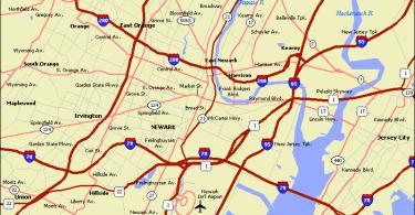
NJ Route 22 terminates its leg in NJ over in Newark, NJ. There are literally no points of interest on this short stretch of roadway in Newark.
Hence, we’re using it merely as a city category placeholder – just for other places we’ll visit in Newark – such as perhaps Weequahic Park at some point in the future.
So – below is your “encyclopedia” entry for Newark. If you want to learn more about the intricacies of NJ Route 22 – Click the About NJ Route 22 (the highway) entry for more.
Newark, New Jersey
Newark is the largest city (by population) in the U.S. state of New Jersey, and the county seat of Essex County. One of the nation’s major air, shipping, and rail hubs, the city had a population of 277,140 in 2010, making it the nation’s 67th most-populous municipality, after being ranked 63rd in the nation in 2000.
Located in the heart of New Jersey’s Gateway Region, Newark is the second-largest city in the New York metropolitan area, approximately 8 miles (13 km) west of Manhattan. Port Newark, the major container shipping terminal in the Port of New York and New Jersey, is the largest on the East Coast. Newark Liberty International Airport was the first municipal commercial airport in the United States, and today is one of its busiest.
Newark is headquarters to numerous corporations, such as Prudential Financial, Audible.com, Panasonic Corporation of North America and PSEG. It is also home to several universities, such as Rutgers–Newark (including the law school and medical school), the New Jersey Institute of Technology, and Seton Hall University’s Law School. Among others, its cultural and sports venues include the New Jersey Performing Arts Center, the Prudential Center, and the Bears & Eagles Riverfront Baseball Stadium.
Newark is divided into five geographical wards, and contains neighborhoods ranging in character from bustling urban districts to quiet suburban enclaves. Newark’s Branch Brook Park is the oldest county park in the United States and is home to the nation’s largest collection of cherry blossom trees, numbering over 5,000.
Geography
According to the United States Census Bureau, the city had a total area of 26.107 square miles (67.617 km), including 24.187 square miles (62.644 km) of land and 1.920 square miles (4.973 km) of water (7.35%) was water. It has the third-smallest land area among the 100 most populous cities in the U.S., behind neighboring Jersey City and Hialeah, Florida. The city’s altitude ranges from 0 (sea level) in the east to approximately 230 feet (70 m) above sea level in the western section of the city. Newark is essentially a large basin sloping towards the Passaic River, with a few valleys formed by meandering streams. Historically, Newark’s high places have been its wealthier neighborhoods. In the 19th century and early 20th century, the wealthy congregated on the ridges of Forest Hill, High Street, and Weequahic.
Until the 20th century, the marshes on Newark Bay were difficult to develop, as the marshes were essentially wilderness, with a few dumps, warehouses, and cemeteries on their edges. During the 20th century, the Port Authority of New York and New Jersey was able to reclaim 68 acres (28 ha) of the marshland for the further expansion of Newark Airport, as well as the growth of the port lands.
Newark is surrounded by residential suburbs to the west (on the slope of the Watchung Mountains), the Passaic River and Newark Bay to the east, dense urban areas to the south and southwest, and middle-class residential suburbs and industrial areas to the north. The city is the largest in New Jersey’s Gateway Region, which is said to have received its name from Newark’s nickname as the “Gateway City.”
Demographics
The city had a population of 277,140 as of the 2010 Census, retaining its position as the largest city in the state and making it the nation’s 67th most-populous municipality. After reaching a peak of 442,337 residents counted in the 1930 Census, the city’s population saw a decline of nearly 40% as residents moved to surrounding suburbs, with the increase in 2010 of 3,594 (+1.3%) from the 273,546 counted in the 2000 Census marking the second census in 70 years in which the city’s population had grown from the previous enumeration.
“White flight” from Newark to the suburbs, which started in the 1940s accelerated in the 1960s. The 1967 riots resulted in a significant population loss of the city’s middle class, many of them Jewish, which continued from the 1970s through to the 1990s. The city lost about 130,000 residents between 1960 and 1990.
From the 1950s to 1967, white population shrank from 363,000 to 158,000, its black population grew from 70,000 to 220,000. The percentage of Non-Hispanic whites declined from 82.8% in 1950 to 11.6% by 2010. The percentage of Latinos in Newark grew between 1980 and 2010, from 18.6% to 33.8% while that of Blacks decreased from 58.2% to 52.4%.
Poverty remains a consistent problem in Newark, despite its revitalization in recent years. As of 2010, roughly one-third of the city’s population is impoverished.
It is believed that heavily immigrant areas of Newark are significantly undercounted in the 2010 Census, especially in the East Ward. Many households refuse to participate in the census, with immigrants often reluctant to submit census forms because they believe that the information could be used to justify their deportation.
2010 Census
At the 2010 United States Census, there were 277,140 people, 94,542 households, and 61,641 families residing in the city. The population density was 11,458.3 per square mile (4,424.1/km). There were 109,520 housing units at an average density of 4,528.1 per square mile (1,748.3/km). The racial makeup of the city was 26.31% (72,914) White, 52.35% (145,085) Black or African American, 0.61% (1,697) Native American, 1.62% (4,485) Asian, 0.04% (118) Pacific Islander, 15.22% (42,181) from other races, and 3.85% (10,660) from two or more races. Hispanics or Latinos of any race were 33.83% (93,746) of the population.
There were 94,542 households, of which 33.7% had children under the age of 18 living with them, 28.0% were married couples living together, 28.9% had a female householder with no husband present, and 34.8% were non-families. 27.9% of all households were made up of individuals, and 8.2% had someone living alone who was 65 years of age or older. The average household size was 2.76 and the average family size was 3.36.
In the city, 25.6% of the population were under the age of 18, 11.9% from 18 to 24, 31.9% from 25 to 44, 22.1% from 45 to 64, and 8.6% who were 65 years of age or older. The median age was 32.3 years. For every 100 females there were 97.9 males. For every 100 females age 18 and over, there were 96.3 males.
The Census Bureau’s 2006-2010 American Community Survey showed that (in 2010 inflation-adjusted dollars) median household income was $35,659 (with a margin of error of +/- $1,009) and the median family income was $41,684 (+/- $1,116). Males had a median income of $34,350 (+/- $1,015) versus $32,865 (+/- $973) for females. The per capita income for the city was $17,367 (+/- $364). About 22.0% of families and 25.0% of the population were below the poverty line, including 34.9% of those under age 18 and 22.4% of those age 65 or over.
Economy
More than 100,000 people commute to Newark each workday, making it the state’s largest employment center with many white-collar jobs in insurance, finance, import-export, health-care, and government. As a major courthouse venue including federal, state, and county facilities, it is home to more than 1,000 law firms. The city is also a “college town”, with nearly 50,000 students attending the city’s universities and medical and law schools. Its airport, maritime port, rail facilities, and highway network make Newark the busiest transshipment hub on the East Coast in terms of volume.
Though Newark is not the industrial colossus of the past, the city does have a considerable amount of industry and light manufacturing. The southern portion of the Ironbound, also known as the Industrial Meadowlands, has seen many factories built since World War II, including a large Anheuser-Busch brewery. The service industry is also growing rapidly, replacing those in the manufacturing industry, which was once Newark’s primary economy. In addition, transportation has become a large business in Newark, accounting for more than 17,000 jobs in 2011.
Newark is one of nine cities in New Jersey designated as eligible for Urban Transit Hub Tax Credits by the state’s Economic Development Authority. Developers who invest a minimum of $50 million within 0.5 miles of a train station are eligible for pro-rated tax credit. After the election of Cory Booker, millions of dollars of public-private partnership investment were made in Downtown development but persistent underemployment continues to characterize many of the city’s neighborhoods. Poverty remains a consistent problem in Newark. As of 2010, roughly one-third of the city’s population is impoverished.
Newark is the third-largest insurance center in the United States, after New York City and Hartford. The Prudential Financial, Mutual Benefit Life, Fireman’s Insurance, and American Insurance Company all originated in the city. The first, one of the largest insurance companies in the world, has its “home office in Newark. Many other companies are headquartered in the city, including IDT Corporation, New Jersey Transit, Public Service Enterprise Group (PSEG), Manischewitz, Horizon Blue Cross and Blue Shield of New Jersey. and Audible.com. In 2013 Panasonic moved its North American headquarters to a new 250,000-square-foot (23,000 m) office building.
Portions of Newark are part of an Urban Enterprise Zone. In addition to other benefits to encourage employment within the Zone, shoppers can take advantage of a reduced 3½% sales tax rate (versus the 7% rate charged statewide) at eligible merchants. While for years there was a dearth of supermarkets since the millennium new ones have opened or are planning to, including the upscale Whole Foods.
Port Newark
Port Newark is the part of Port Newark-Elizabeth Marine Terminal and the largest cargo facility in the Port of New York and New Jersey. Located on Newark Bay, it is run by the Port Authority of New York and New Jersey and serves as the principal container ship facility for goods entering and leaving the New York metropolitan region and the northeastern quadrant of North America. The Port moved over $100 billion in goods in 2003, making it the 15th busiest in the world at the time, but was the number one container port as recently as 1985. Plans are underway for billions of dollars of improvements – larger cranes, bigger railyard facilities, deeper channels, and expanded wharves.
Roads and highways
As of May 2010, the city had a total of 368.21 miles (592.58 km) of roadways, of which 318.77 miles (513.01 km) were maintained by the municipality, 17.61 miles (28.34 km) by Essex County and 22.66 miles (36.47 km) by the New Jersey Department of Transportation and 9.17 miles (14.76 km) by the New Jersey Turnpike Authority.
Newark is served by numerous highways including the New Jersey Turnpike (Interstate 95), Interstate 280, Interstate 78, the Garden State Parkway, U.S. Route 1/9, U.S. Route 22, and Route 21. Newark is connected to the Holland Tunnel and Lower Manhattan by the Pulaski Skyway, spanning both the Passaic and Hackensack Rivers, which was first constructed in 1938 and will be undergoing a $900 million renovation project.
Local streets in Newark conform to a quasi-grid form, with major streets radiating outward (like spokes on a wheel) from the downtown area. Some major roads in the city are named after the towns to which they lead, including South Orange Avenue, Springfield Avenue, and Bloomfield Avenue, as well as Broadway, which had been renamed from Belleville Avenue.
In a city extensively served by mass transit, 44.2% of Newark residents did not have a car as of the 2000 Census, ranked second in the U.S. to New York City in the proportion of households without an automobile among cities with more than 250,000 people.
Public transportation
Newark is served by several dozen New Jersey Transit bus routes.
The go bus 25 and go bus 28 are bus rapid transit lines through the cities of Irvington, Bloomfield and Newark Liberty International Airport.
Crime
In 1996, Time magazine ranked Newark “The Most Dangerous City in the Nation.” By 2007, however, the city recorded a total of 99 homicides for the year, representing a significant drop from the record of 161 murders set in 1981. The number of murders in 2008 dropped to 65, a decline of 30% from the previous year and the lowest in the city since 2002 when there were also 65 murders.
In 2010, Newark recorded 90 homicides. March 2010 was the first calendar month since 1966 in which the city did not record a homicide. Overall, there was a 6% increase in crime numbers over the previous year, including a rise in carjackings for the third straight year, with the 337 incidents raising concerns that the city was returning to its status as the “car theft capital of the world”. Along with the increase in crime, the Newark Police Department increased its recovery of illegally owned guns in 2011 to 696, up from 278 in 2010. The Federal Bureau of Investigation recorded 94 homicides in 2011 and 95 in 2012. In 2012 CNNMoney ranked Newark as the 6th most dangerous city in the United States based on numbers by FBI Crime in the United States 2011 report. The city had 10 murders in 10 days during the period ending September 6, 2013, a statistic largely attributed to the reduction of the police force. In 2013 Newark recorded 111 homicides, the first year ending in triple digits in seven years and the highest tally since 1990 and accounting for 27% of all murders statewide. In 2014, the total number of homicides in Newark was 93, while Essex County as a whole had 117 murders. A local news rag reported that there were 105 homicides in the city in 2015.
(SOURCE: Infogalactic)


NJ Route 22 Comment Section