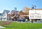
Hampton, NJ
Hampton, NJ is a small mile and a half square town – but has a fairly decent representation on Route 31, hence why we’re listing it on NJroute22.com.
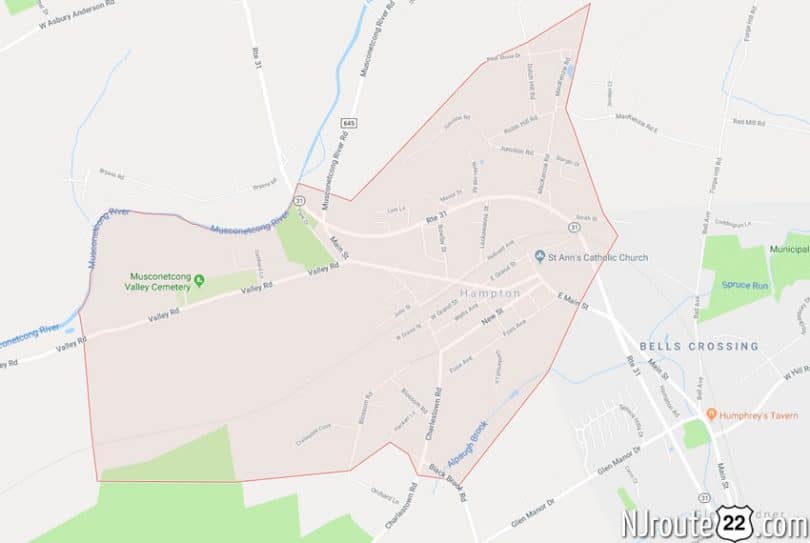
Hampton, New Jersey (Hunterdon County)

Where Hampton, NJ is – wider view perspective.
Hampton is a borough in Hunterdon County, New Jersey, United States. As of the 2010 United States Census, the borough’s population was 1,401, reflecting a decline of 145 (-9.4%) from the 1,546 counted in the 2000 Census, which had in turn increased by 31 (+2.0%) from the 1,515 counted in the 1990 Census.
What is now Hampton was originally incorporated by an act of the New Jersey Legislature as Junction Borough on February 20, 1895, from portions of both Lebanon Township and Bethlehem Township, based on the results of a referendum held on the previous day. By a resolution of the borough council, the name was changed to Hampton as of February 11, 1909. In 1931, additional territory was annexed from both Glen Gardner borough and Bethlehem Township.
Located on the banks of the Musconetcong River, Hampton has changed little since it was first settled in 1800. In 1880, the town consisted of a store, hotel, cabinet manufacturer, blacksmith, wheelwright shop, grist mill, school house and about 25 dwellings. Hampton was once known as “Junction” because the Central Railroad of New Jersey and the Delaware, Lackawanna and Western Railroad crossed through here.
Geography
According to the United States Census Bureau, the borough had a total area of 1.545 square miles (4.001 km), including 1.531 square miles (3.965 km) of land and 0.014 square miles (0.036 km) of water (0.89%).
The borough borders Bethlehem Township, Glen Gardner Borough and Lebanon Township. Hampton also borders Warren County.
Hampton Junction is an unincorporated community within Hampton.
Demographics
| Historical population | |||
|---|---|---|---|
| Census | Pop. | %± | |
| 1900 | 998 | — | |
| 1910 | 914 | −8.4% | |
| 1920 | 916 | 0.2% | |
| 1930 | 861 | −6.0% | |
| 1940 | 864 | 0.3% | |
| 1950 | 975 | 12.8% | |
| 1960 | 1,135 | 16.4% | |
| 1970 | 1,386 | 22.1% | |
| 1980 | 1,614 | 16.5% | |
| 1990 | 1,515 | −6.1% | |
| 2000 | 1,546 | 2.0% | |
| 2010 | 1,401 | −9.4% | |
| Est. 2014 | 1,373 | −2.0% | |
Census 2010
At the 2010 United States Census, there were 1,401 people, 570 households, and 368.2 families residing in the borough. The population density was 915.1 per square mile (353.3/km). There were 612 housing units at an average density of 399.7 per square mile (154.3/km). The racial makeup of the borough was 92.29% (1,293) White, 2.50% (35) Black or African American, 0.71% (10) Native American, 1.86% (26) Asian, 0.07% (1) Pacific Islander, 1.00% (14) from other races, and 1.57% (22) from two or more races. Hispanics or Latinos of any race were 5.35% (75) of the population.
There were 570 households, of which 29.3% had children under the age of 18 living with them, 50.4% were married couples living together, 9.5% had a female householder with no husband present, and 35.4% were non-families. 30.2% of all households were made up of individuals, and 14.4% had someone living alone who was 65 years of age or older. The average household size was 2.46 and the average family size was 3.11.
In the borough, 21.6% of the population were under the age of 18, 8.1% from 18 to 24, 25.8% from 25 to 44, 31.1% from 45 to 64, and 13.4% who were 65 years of age or older. The median age was 41.6 years. For every 100 females there were 101.0 males. For every 100 females age 18 and over, there were 97.0 males.
The Census Bureau’s 2006-2010 American Community Survey showed that (in 2010 inflation-adjusted dollars) median household income was $63,681 (with a margin of error of +/- $9,751) and the median family income was $82,396 (+/- $19,162). Males had a median income of $54,500 (+/- $9,914) versus $33,594 (+/- $8,886) for females. The per capita income for the borough was $30,468 (+/- $3,353). About 10.2% of families and 10.0% of the population were below the poverty line, including 17.3% of those under age 18 and 10.1% of those age 65 or over.
Transportation
As of May 2010, the borough had a total of 8.80 miles (14.16 km) of roadways, of which 6.62 miles (10.65 km) were maintained by the municipality, 1.05 miles (1.69 km) by Hunterdon County and 1.13 miles (1.82 km) by the New Jersey Department of Transportation.
Notable people
People who were born in, residents of, or otherwise closely associated with Hampton include:
- Daryl Cobb (born 1961), children’s book author.
- Stephen Dilts, former commissioner of the New Jersey Department of Transportation who served as mayor of Hampton.
- Frank L. Howley (1903-1993), United States Army Brigadier General.
- Sidney Rivera (born 1993), professional soccer player.
- Matt Walton (born 1973), stage, screen and television actor who appeared on Onion SportsDome.
- Glenway Wescott (1901–1987), novelist.
- Bernie Worrell (born 1944), keyboardist for Parliament-Funkadelic.