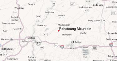
Pohatcong Township, NJ
Pohatcong Township is a township in Warren County, New Jersey, United States, located in the easternmost region of the Lehigh Valley. As of the 2010 United States Census, the township’s population was 3,339, reflecting a decline of 77 (-2.3%) from the 3,416 counted in the 2000 Census, which had in turn declined by 175 (-4.9%) from the 3,591 counted in the 1990 Census. The name Pohatcong is said to be from the Lenni Lenape Native American term meaning “stream between split hills”.
Pohatcong Township was officially established in 1881. On March 24, 1881 Chapter 145 of the Acts of the New Jersey General Assembly was published defining and creating Pohatcong Township. The act to form Pohatcong had been introduced by Assmeblyman William Fritts and, once law, was to take effect January 1 of the following year. Pohatcong was incorporated on January 1, 1882. It was divided off of Greenwich Township. Pohatcong township’s name comes from Lenape Native Americans, who called the area “split hills stream outlet”. The industrialized center of the township was separated to form Alpha borough, on April 27, 1911.
Geography
According to the United States Census Bureau, the township had a total area of 13.712 square miles (35.514 km), including 13.355 square miles (34.590 km) of land and 0.357 square miles (0.924 km) of water (2.60%).
Finesville (with a 2010 Census population of 175) and Upper Pohatcong (2010 population of 1,781) are unincorporated communities and census designated places (CDPs) located within the township. Other unincorporated communities, localities and place names located partially or completely within the township include Carpentersville, Hughesville, Huntington, Kennedys, Riegelsville, Springtown, Warren and Warren Glen.
Pohatcong completely surrounds Alpha.
Demographics
| Historical population | |||
|---|---|---|---|
| Census | Pop. | %± | |
| 1890 | 1,483 | — | |
| 1900 | 2,215 | 49.4% | |
| 1910 | 3,202 | 44.6% | |
| 1920 | 1,559 | * | −51.3% |
| 1930 | 1,974 | 26.6% | |
| 1940 | 2,029 | 2.8% | |
| 1950 | 2,540 | 25.2% | |
| 1960 | 3,543 | 39.5% | |
| 1970 | 3,924 | 10.8% | |
| 1980 | 3,856 | −1.7% | |
| 1990 | 3,591 | −6.9% | |
| 2000 | 3,416 | −4.9% | |
| 2010 | 3,339 | −2.3% | |
| Est. 2014 | 3,259 | −2.4% | |
| * = Lost territory in previous decade | |||
The Township’s economic data (as is all of Warren County) is calculated by the US Census Bureau as part of the Allentown-Bethlehem-Easton, PA-NJ Metropolitan Statistical Area.
Census 2010
At the 2010 United States Census, there were 3,339 people, 1,310 households, and 941.9 families residing in the township. The population density was 250.0 per square mile (96.5/km). There were 1,420 housing units at an average density of 106.3 per square mile (41.0/km). The racial makeup of the township was 95.24% (3,180) White, 1.59% (53) Black or African American, 0.03% (1) Native American, 0.90% (30) Asian, 0.00% (0) Pacific Islander, 0.69% (23) from other races, and 1.56% (52) from two or more races. Hispanics or Latinos of any race were 3.47% (116) of the population.
There were 1,310 households, of which 29.8% had children under the age of 18 living with them, 58.8% were married couples living together, 8.6% had a female householder with no husband present, and 28.1% were non-families. 23.4% of all households were made up of individuals, and 10.8% had someone living alone who was 65 years of age or older. The average household size was 2.55 and the average family size was 3.01.
In the township, 22.6% of the population were under the age of 18, 6.6% from 18 to 24, 24.3% from 25 to 44, 31.6% from 45 to 64, and 14.9% who were 65 years of age or older. The median age was 42.8 years. For every 100 females there were 100.2 males. For every 100 females age 18 and over, there were 97.3 males. The Census Bureau’s 2006-2010 American Community Survey showed that (in 2010 inflation-adjusted dollars) median household income was $84,318 (with a margin of error of +/- $14,047) and the median family income was $95,982 (+/- $2,028). Males had a median income of $56,705 (+/- $13,134) versus $35,481 (+/- $1,974) for females. The per capita income for the borough was $34,781 (+/- $7,346). About 3.9% of families and 4.9% of the population were below the poverty line, including 2.2% of those under age 18 and 3.9% of those age 65 or over.
Economy
The Phillipsburg Mall is located on the border of Pohatcong and Lopatcong Township. 43 acres (17 ha) of the mall is located in Pohatcong, with the portion of the property in the township being assessed for $39.8 million, one of the highest valuations in the municipality.
Transportation
Roads and highways
As of May 2010, the township had a total of 54.70 miles (88.03 km) of roadways, of which 36.13 miles (58.15 km) were maintained by the municipality, 12.81 miles (20.62 km) by Warren County, 3.20 miles (5.15 km) by the New Jersey Department of Transportation and 2.56 miles (4.12 km) by the Delaware River Joint Toll Bridge Commission.
The major county road that passes through is CR 519.
Route 122 is the only major state road that passes through (which used to be U.S. Route 22 ALT until it was changed in 1993).
Interstate 78 passes through in the central region while U.S. Route 22 runs along the eastern border before running concurrently with I-78.
The Riegelsville Bridge is a suspension bridge crossing the Delaware River connecting Pohatcong to Riegelsville, Pennsylvania, that is owned and operated by the Delaware River Joint Toll Bridge Commission. The current bridge on the site opened in 1904.
Public transportation
Trans-Bridge Lines operates the 890 and 891 bus routes, which connect Pohatcong Township with Easton, Pennsylvania.
(SOURCE: Infogalactic)