About North Plainfield, NJ
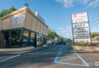
North Plainfield, NJ is very similar in appearance to Green Brook, insomuch that it’s a narrow town with NJ Route 22 running 3 miles down the center of it. From a drivers perspective, there are no immediately obvious distinctions. We’ll have to delve deeper to see what’s going on. Any suggestions? Contact us.
See “encyclopedia” entry below:
North Plainfield, New Jersey
North Plainfield is a borough in Somerset County, New Jersey, United States. As of the 2010 United States Census, the borough’s population was 21,936, reflecting an increase of 833 (+3.9%) from the 21,103 counted in the 2000 Census, which had in turn increased by 2,283 (+12.1%) from the 18,820 counted in the 1990 Census.
North Plainfield Township was created from portions of Warren Township, New Jersey by an Act of the New Jersey Legislature passed on April 2, 1872. The borough of North Plainfield became an independent municipality on June 9, 1885. The name derives from Plainfield, which derived its name from a local estate or from its scenic location.
In 1902, the New Jersey Legislature approved measures that would have allowed the borough to become part of Union County (a measure repealed in 1903) and to allow for a merger of North Plainfield with the City of Plainfield subject to the approval of a referendum by voters in both municipalities.
North Plainfield is home to the Washington Park Historic District.
Geography
According to the United States Census Bureau, the borough had a total area of 2.807 square miles (7.270 km), including 2.794 square miles (7.237 km) of land and 0.013 square miles (0.032 km) of water (0.45%).
The borough is bordered by Watchung to the north, Green Brook Township to the southwest, and Plainfield to the south in Union County.
North Plainfield is in the northern division of the Raritan Valley along with Green Brook.
Demographics
| Historical population | |||
|---|---|---|---|
| Census | Pop. | %± | |
| 1900 | 5,009 | — | |
| 1910 | 6,117 | 22.1% | |
| 1920 | 6,916 | 13.1% | |
| 1930 | 9,760 | 41.1% | |
| 1940 | 10,586 | 8.5% | |
| 1950 | 12,766 | 20.6% | |
| 1960 | 16,993 | 33.1% | |
| 1970 | 21,796 | 28.3% | |
| 1980 | 19,108 | −12.3% | |
| 1990 | 18,820 | −1.5% | |
| 2000 | 21,103 | 12.1% | |
| 2010 | 21,936 | 3.9% | |
| Est. 2014 | 22,029 | 0.4% | |
Census 2010
At the 2010 United States Census, there were 21,936 people, 7,448 households, and 5,266 families residing in the borough. The population density was 7,850.0 per square mile (3,030.9/km). There were 7,848 housing units at an average density of 2,808.5 per square mile (1,084.4/km). The racial makeup of the borough was 55.01% (12,066) White, 18.85% (4,134) Black or African American, 0.29% (63) Native American, 5.81% (1,275) Asian, 0.05% (12) Pacific Islander, 16.00% (3,510) from other races, and 3.99% (876) from two or more races. Hispanics or Latinos of any race were 44.21% (9,699) of the population.
There were 7,448 households, of which 35.8% had children under the age of 18 living with them, 48.3% were married couples living together, 15.0% had a female householder with no husband present, and 29.3% were non-families. 22.8% of all households were made up of individuals, and 6.1% had someone living alone who was 65 years of age or older. The average household size was 2.94 and the average family size was 3.40.
In the borough, 24.5% of the population were under the age of 18, 8.9% from 18 to 24, 33.0% from 25 to 44, 25.2% from 45 to 64, and 8.4% who were 65 years of age or older. The median age was 35.1 years. For every 100 females there were 100.8 males. For every 100 females age 18 and over, there were 98.5 males.
The Census Bureau’s 2006-2010 American Community Survey showed that (in 2010 inflation-adjusted dollars) median household income was $67,815 (with a margin of error of +/- $2,878) and the median family income was $70,359 (+/- $5,666). Males had a median income of $42,766 (+/- $2,549) versus $43,057 (+/- $3,208) for females. The per capita income for the borough was $27,529 (+/- $1,466). About 5.3% of families and 7.3% of the population were below the poverty line, including 11.8% of those under age 18 and 6.7% of those age 65 or over.
Transportation
Roads and highways
As of May 2010, the borough has a total of 49.77 miles (80.10 km) of roads, of which 39.28 miles (63.22 km) were maintained by the municipality, 7.22 miles (11.62 km) by the county and 3.27 miles (5.26 km) by the New Jersey Department of Transportation.
Major roadways in the borough include U.S. Route 22. County Route 531 also passes through.
Public transportation
New Jersey Transit rail service is available at the Plainfield station on the Raritan Valley Line to Newark Penn Station, with connecting service to Hoboken Terminal and Penn Station New York.
NJ Transit bus service to and from the Port Authority Bus Terminal in Midtown Manhattan is available on the 114 and 117 routes, to Newark on the 65 and 66 routes, with local service on the 822 and 986 routes.
Noted residents
People who were born in, residents of, or otherwise closely associated with North Plainfield include:
- Hank Beenders (1916–2003), one of the first foreign-born players in what is now the NBA.
- Jack Bicknell, Jr. (born 1963), football coach who had been an assistant offensive line coach with the New York Giants.
- Kay Blumetta (1923–1997), pitcher who played in the All-American Girls Professional Baseball League.
- Dan Canter (born 1961), soccer defender who played three seasons in the North American Soccer League and three in Major Indoor Soccer League, in addition to playing with the United States men’s national soccer team.
- Pete Carmichael (born 1941), former football coach.
- Allan Crite (1910–2007), artist.
- John DiMaggio (born 1968), actor, voice of Bender on Futurama.
- Charles Aubrey Eaton (1868–1953), clergyman and politician who represented New Jersey’s 4th congressional district from 1925-1933 and New Jersey’s 5th congressional district from 1933-1953.
- Bill Evans (1929–1980), jazz musician.
- David T. Kenney (1866–1922), vacuum cleaner inventor and manufacturer.
- Anthony Krizan, lead guitarist for the Spin Doctors.
- Jack Melick (born 1929), bandleader, pianist and arranger.
- Barry Miles (born 1947), pianist, drummer, composer and producer.
- Molly Price (born 1966), actress.
- Jorge Rodriguez-Gerada (born 1966), Cuban-born contemporary artist.
- Steve Schmidt (born 1970), senior campaign strategist to the 2008 presidential campaign of Senator John McCain.
- John R. Winckler (1916–2001), physicist best known for his discovery of sprites, a variety of lightning found in the upper atmosphere.
(SOURCE: Infogalactic)


