
About High Bridge, NJ
High Bridge, NJ is important for inclusion on NJroute22.com, for several reasons.
It’s proximity to Route 22, Route 31, and Route78 – and because it houses an NJ Transit station.
And of course, it’s a quaint little town that might be of interest!
High Bridge, New Jersey
High Bridge is a borough in Hunterdon County, New Jersey, United States. As of the 2010 United States Census, the borough’s population was 3,648, reflecting a decline of 128 (-3.4%) from the 3,776 counted in the 2000 Census, which had in turn declined by 110 (-2.8%) from the 3,886 counted in the 1990 Census.
History

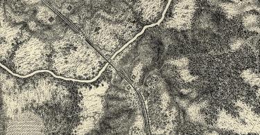
High Bridge, NJ – a wider perspective.
High Bridge was originally incorporated as a township by an act of the New Jersey Legislature on March 29, 1871, from portions of Clinton Township and Lebanon Township. On February 19, 1898, the borough of High Bridge was incorporated from portions of the township, with the remainder returned to Clinton and Lebanon Townships five days later.
The borough is located on the South Branch of the Raritan River in the north central part of Hunterdon County. Water from the South Branch was a valuable power source for one of the first ironworks in the United States, established in the 1740s by William Allen and Joseph Turner of Philadelphia. Allen was the mayor of Philadelphia, a Chief Justice of Pennsylvania, and a prominent landowner in New Jersey. In 1859, the Central Railroad of New Jersey began a five-year construction project of a 112-foot (34 m) high, 1,300-foot (400 m) long bridge across the river from which structure the locality ultimately took its name.
Geography
According to the United States Census Bureau, the borough had a total area of 2.431 square miles (6.297 km), including 2.389 square miles (6.188 km) of land and 0.042 square miles (0.109 km) of water (1.74%). It is drained by the South Branch of the Raritan River.
High Bridge borders the Hunterdon County municipalities of Clinton Township and Lebanon Township.
Unincorporated communities, localities and place names located partially or completely within the township include Jericho Hill, Pierce Heights and Silverthorn.
Demographics
| Historical population | |||
|---|---|---|---|
| Census | Pop. | %± | |
| 1880 | 2,209 | — | |
| 1890 | 1,935 | −12.4% | |
| 1900 | 1,377 | −28.8% | |
| 1910 | 1,545 | 12.2% | |
| 1920 | 1,795 | 16.2% | |
| 1930 | 1,860 | 3.6% | |
| 1940 | 1,781 | −4.2% | |
| 1950 | 1,854 | 4.1% | |
| 1960 | 2,148 | 15.9% | |
| 1970 | 2,606 | 21.3% | |
| 1980 | 3,435 | 31.8% | |
| 1990 | 3,886 | 13.1% | |
| 2000 | 3,776 | −2.8% | |
| 2010 | 3,648 | −3.4% | |
| Est. 2014 | 3,588 | −1.6% | |
Census 2010
At the 2010 United States Census, there were 3,648 people, 1,418 households, and 1,004 families residing in the borough. The population density was 1,526.9 per square mile (589.5/km). There were 1,481 housing units at an average density of 619.9 per square mile (239.3/km). The racial makeup of the borough was 93.17% (3,399) White, 1.32% (48) Black or African American, 0.22% (8) Native American, 3.18% (116) Asian, 0.00% (0) Pacific Islander, 0.74% (27) from other races, and 1.37% (50) from two or more races. Hispanics or Latinos of any race were 6.00% (219) of the population.
There were 1,418 households, of which 33.6% had children under the age of 18 living with them, 58.3% were married couples living together, 9.0% had a female householder with no husband present, and 29.2% were non-families. 22.9% of all households were made up of individuals, and 5.3% had someone living alone who was 65 years of age or older. The average household size was 2.57 and the average family size was 3.06.
In the borough, 24.3% of the population were under the age of 18, 6.9% from 18 to 24, 28.0% from 25 to 44, 32.3% from 45 to 64, and 8.6% who were 65 years of age or older. The median age was 39.9 years. For every 100 females there were 101.2 males. For every 100 females age 18 and over, there were 101.4 males.
The Census Bureau’s 2006-2010 American Community Survey showed that (in 2010 inflation-adjusted dollars) median household income was $90,037 (with a margin of error of +/- $10,054) and the median family income was $108,148 (+/- $6,913). Males had a median income of $77,500 (+/- $10,021) versus $47,936 (+/- $5,291) for females. The per capita income for the borough was $40,866 (+/- $4,587). About 0.0% of families and 0.8% of the population were below the poverty line, including 0.0% of those under age 18 and 0.0% of those age 65 or over.
Economy
High Bridge has a downtown (Main Street) that is home to eateries, services, and professionals. Circa Restaurant, at the center of Main Street, has received acclaim from a variety of sources including a food editor from The New York Times who proclaimed, “Circa is the kind of place I wish were in my town.”
The businesses are collectively marketed by the High Bridge Business Association, which assists its member businesses through co-operative advertising, press releases, goodwill and other benefits.
Parks and recreation
High Bridge serves as the southern terminus of a rail trail that was created out of the former Central Railroad of New Jersey High Bridge Branch. The trail is maintained by Hunterdon County Parks and Recreation and is called the Columbia Trail. The trail runs northeastward from the center of the borough (at the junction of Main Street and Church Street) towards Califon, through a scenic area outside the borough limits, known as the Ken Lockwood Gorge.
Union Forge Park is High Bridge’s main public park, located across the Raritan River from Taylor Wharton. Another park is the Borough Commons, situated at the start of the Columbia Trail. A grant received by the Union Forge Heritage Association in 2008 provided for the creation of the Taylor Steelworkers Historical Greenway, which stretches 5 ⁄4 miles (8.4 km) around the borough, starting at Columbia Trail and connecting the borough’s parks and other historic sites.
The High Bridge Hills golf course, located near Route 31, provides another means of recreation in the small town.
Roads and highways
As of May 2010, the borough had a total of 21.00 miles (33.80 km) of roadways, of which 18.99 miles (30.56 km) were maintained by the municipality and 2.01 miles (3.23 km) by Hunterdon County.
CR 513 is the main road that passes through and connects to Route 31 to the west.
Interstate 78 is accessible via Routes 513 and 31 in neighboring Clinton Township.
Public transportation
Originally a vital junction for the Central Railroad of New Jersey in hauling iron ore from northern New Jersey via its High Bridge Branch which headed north toward Wharton, High Bridge now serves as the westernmost station on New Jersey Transit‘s Raritan Valley Line. It is located at the southern end of the station. The parking lot for the station is located one block to the west. The station only uses the southern track for inbound and outbound trains. There is a station building that is no longer used and there are two small shelters. This station has limited weekday service and no weekend service. The station has been the western terminus of the line since 1983, the year NJT commenced operations. Between 1983 and 1989, NJT reached Phillipsburg, New Jersey on the former Central Railroad of New Jersey mainline. Since that time, the route between High Bridge and Phillipsburg has been inactive. NJT considers making plans for bringing service back to Phillipsburg again in the future.
Points of interest
Solitude House, built circa 1710-1725, became the centerpiece of the iron plantation that became Union Forge Ironworks. Later called Taylor Iron and Steel Company, it eventually became known as Taylor-Wharton. John Penn, the last royal governor of Pennsylvania, and Benjamin Chew, the last Chief Justice of the Supreme Court of Pennsylvania, were political prisoners at Solitude House during the American Revolutionary War. Five generations of the Taylor family managed the business and continued to live in the house, until 1938. Acquired by the Borough in 2001, and previously operated as a museum, the house is currently closed due to a lease dispute. The Union Forge Heritage Association operated Solitude House Museum from 2002 to 2012.
The Taylor SteelWorkers Historical Greenway, created by the Union Forge Heritage Association, connects to the Columbia Trail.
The TISCO Headquarters, constructed in 1742 for the Union Iron Works, is the oldest office building in New Jersey.
Lake Solitude dam, replacing the crib dam of 1858, replaced in 1909, is the last remaining example of a buttress dam in New Jersey, built by master engineer Frank S. Tainter.
Springside Farm was established in 1803, by Archibald S. Taylor, as the agricultural farm of the Taylor Iron and Steel Company.
The Paul Robinson Observatory is an astronomical observatory owned and operated by Edwin E. Aldrin Astronomical Center.
Notable people
People who were born in, residents of, or otherwise closely associated with High Bridge include:
- Frank Baldwin (1928–2004), Major League Baseball catcher who played for the Cincinnati Reds.
- Naomi Jakobsson (born 1941 as Naomi Dick), represents the 103rd District in the Illinois House of Representatives.
- Howard Menger (1922–2009), UFO contactee whose writings on the subject include The High Bridge Incident, about his initial contact with aliens, when he was ten years old.
- Dan Smith (born 1975), former MLB pitcher who played for the Montreal Expos and Boston Red Sox.
- George W. Taylor (1808–1862), Union Army brigadier general during the American Civil War.


NJ Route 22 Comment Section