About Hellertown, PA
Hellertown, PA is included on NJroute22.com because of its “connection” to Bethlehem, as it’s just on the other side of Route 78, and we’ve often found ourselves meandering through for a pit stop (gas, supplies, etc.)
We’ll see if we can find noteworthy topics about Hellertown in the future!
Hellertown, Pennsylvania

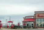
Hellertown, PA – wide view perspective.
Hellertown is a borough in Northampton County, Pennsylvania, in the United States. Hellertown is located in the Lehigh Valley region of the state, and geographically in the Saucon Valley.
The population of Hellertown was 5,606 at the 2000 census.
Geography
Hellertown is located at 40°35′3″N 75°20′17″W (40.584099, -75.338139).

According to the United States Census Bureau, the borough has a total area of 1.3 square miles (3.4 km2), all of it land.
Transportation
Center Valley was once served by the R5 Allentown line
Demographics
| Historical population | |||
|---|---|---|---|
| Census | Pop. | %± | |
| 1880 | 605 | — | |
| 1890 | 708 | 17.0% | |
| 1900 | 745 | 5.2% | |
| 1910 | 915 | 22.8% | |
| 1920 | 3,008 | 228.7% | |
| 1930 | 3,851 | 28.0% | |
| 1940 | 4,031 | 4.7% | |
| 1950 | 5,435 | 34.8% | |
| 1960 | 6,716 | 23.6% | |
| 1970 | 6,615 | −1.5% | |
| 1980 | 6,025 | −8.9% | |
| 1990 | 5,662 | −6.0% | |
| 2000 | 5,606 | −1.0% | |
| 2010 | 5,898 | 5.2% | |
| Est. 2014 | 5,858 | −0.7% | |
As of the census of 2000, there were 5,606 people, 2,448 households, and 1,571 families residing in the borough. The population density was 4,180.8 people per square mile (1,615.3/km). There were 2,570 housing units at an average density of 1,916.6 per square mile (740.5/km). The racial makeup of the borough was 98.20% White, 0.30% African American, 0.07% Native American, 0.20% Asian, 0.68% from other races, and 0.55% from two or more races. Hispanic or Latino of any race were 2.48% of the population.
There were 2,448 households, out of which 24.7% had children under the age of 18 living with them, 51.2% were married couples living together, 10.3% had a female householder with no husband present, and 35.8% were non-families. 30.5% of all households were made up of individuals, and 17.2% had someone living alone who was 65 years of age or older. The average household size was 2.29 and the average family size was 2.85.
In the borough the population was distributed, with 20.2% under the age of 18, 6.6% from 18 to 24, 29.0% from 25 to 44, 21.2% from 45 to 64, and 23.1% who were 65 years of age or older. The median age was 42 years. For every 100 females there were 89.3 males. For every 100 females age 18 and over, there were 86.2 males.
The median income for a household in the borough was $39,651, and the median income for a family was $49,604. Males had a median income of $37,935 versus $26,322 for females. The per capita income for the borough was $20,119. About 4.1% of families and 4.6% of the population were below the poverty line, including 6.5% of those under age 18 and 3.3% of those age 65 or over.
Notable people
- Home of Allen Woodring, 1920 Olympic gold medalist in the 200m.
- Birthplace (November 3, 1906) of the mathematician and professor Carl Benjamin Boyer
- Home of Ted Poley, Lead singer of the 80’s Rock Band Danger Danger