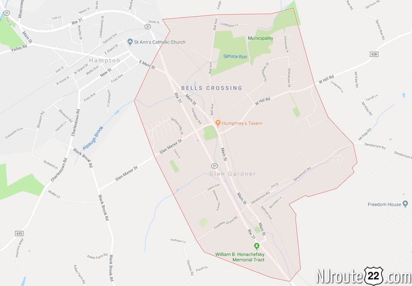
Glen Gardner, NJ
Like Hampton, NJ, Glen Gardner, NJ is also a small 1.5 square mile town that has a presence on Route 31, which why it is included on NJroute22.com.
Glen Gardner, New Jersey

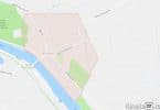
Where Glen Gardner is, a wider perspective.
Glen Gardner is a borough in Hunterdon County, New Jersey, United States. At the time of the 2010 United States Census, the borough’s population was 1,704, reflecting a decline of 198 (-10.4%) from the 1,902 counted in the 2000 Census, which had in turn increased by 237 (+14.2%) from the 1,665 counted in the 1990 Census.
Glen Gardner is located at the extreme western border of Lebanon Township and was incorporated as a borough by an act of the New Jersey Legislature on March 26, 1919, from portions of both Lebanon Township and Bethlehem Township based on the results of a referendum held that same day. Portions of the borough were ceded to Hampton borough in 1931.
The area that is now Glen Gardner had been known as Eveland’s Tavern for tavernkeeper John Eveland. Later, the area was variously called Spruce Run Mills and Sodom. The name of both the community and post office were officially changed to Glen Gardner in 1871 in honor of the Gardner brothers who owned a chair and frame factory in the area.
Geography
According to the United States Census Bureau, the borough had a total area of 1.524 square miles (3.948 km), all of which was land.
Unincorporated communities, localities and place names located partially or completely within the borough include:
Bells Crossing and Clarksville are unincorporated communities located within Glen Gardner.
The borough borders the Hunterdon County municipalities of Bethlehem Township, Hampton Borough, and Lebanon Township.
Demographics
| Historical population | |||
|---|---|---|---|
| Census | Pop. | %± | |
| 1920 | 818 | — | |
| 1930 | 554 | −32.3% | |
| 1940 | 536 | −3.2% | |
| 1950 | 654 | 22.0% | |
| 1960 | 787 | 20.3% | |
| 1970 | 874 | 11.1% | |
| 1980 | 834 | −4.6% | |
| 1990 | 1,665 | 99.6% | |
| 2000 | 1,902 | 14.2% | |
| 2010 | 1,704 | −10.4% | |
| Est. 2014 | 1,676 | −1.6% | |
Census 2010
At the 2010 United States Census, there were 1,704 people, 768 households, and 433.9 families residing in the borough. The population density was 1,117.8 per square mile (431.6/km). There were 825 housing units at an average density of 541.2 per square mile (209.0/km). The racial makeup of the borough was 94.54% (1,611) White, 1.76% (30) Black or African American, 0.06% (1) Native American, 1.82% (31) Asian, 0.00% (0) Pacific Islander, 0.35% (6) from other races, and 1.47% (25) from two or more races. Hispanics or Latinos of any race were 5.28% (90) of the population.
There were 768 households, of which 28.4% had children under the age of 18 living with them, 45.1% were married couples living together, 8.5% had a female householder with no husband present, and 43.5% were non-families. 35.3% of all households were made up of individuals, and 7.6% had someone living alone who was 65 years of age or older. The average household size was 2.22 and the average family size was 2.97.
In the borough, 21.3% of the population were under the age of 18, 6.6% from 18 to 24, 28.5% from 25 to 44, 34.8% from 45 to 64, and 8.8% who were 65 years of age or older. The median age was 41.6 years. For every 100 females there were 97.7 males. For every 100 females age 18 and over, there were 91.6 males.
The Census Bureau’s 2006-2010 American Community Survey showed that (in 2010 inflation-adjusted dollars) median household income was $73,750 (with a margin of error of +/- $15,026) and the median family income was $98,693 (+/- $9,105). Males had a median income of $62,434 (+/- $12,072) versus $49,417 (+/- $13,970) for females. The per capita income for the borough was $37,184 (+/- $4,006). About 1.2% of families and 2.3% of the population were below the poverty line, including 1.4% of those under age 18 and 7.6% of those age 65 or over.
Transportation
As of May 2010, the borough had a total of 10.89 miles (17.53 km) of roadways, of which 7.84 miles (12.62 km) were maintained by the municipality, 1.36 miles (2.19 km) by Hunterdon County and 1.69 miles (2.72 km) by the New Jersey Department of Transportation.
Notable people
People who were born in, residents of, or otherwise closely associated with Glen Gardner include:
- Whittaker Chambers (1901–1961), writer and editor who testified against Alger Hiss about their work for Soviet intelligence.
- Wyllis Cooper (1899–1955), radio writer.
- Brendan Cusack (born 1992), fencer.
- Wesley Lance (c. 1909-2007), member of both the New Jersey General Assembly and the New Jersey Senate.
- Anne Marie Letko (born 1969), long-distance runner who competed in the Summer Olympics in 1996 and 2000.