
About Frenchtown, NJ
Many people have heard about, or even have been to Frenchtown, NJ. Mainly because of it’s “artsy” progressive community. We include it on NJroute22.com because it is a decent destination for a day trip on nice days. Relatively easy to get to – with plenty of other places of interest on the way to and from!
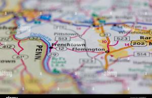
Frenchtown, New Jersey
To put Frenchtown, NJ in a wider perspective.
Frenchtown is a borough in Hunterdon County, New Jersey, United States. As of the 2010 United States Census, the borough’s population was 1,373, reflecting a decline of 115 (-7.7%) from the 1,488 counted in the 2000 Census, which had in turn declined by 40 (-2.6%) from the 1,528 counted in the 1990 Census.
Frenchtown is located along the banks of the Delaware River on the Hunterdon Plateau. Various names have been applied to this settlement, after the many ferry operators residing on both sides of the river. The community had variously been known as Alexandria Ville, Sunbeam and Frenchtown over the years. The Borough was formed by an act of the New Jersey Legislature on April 4, 1867, from portions of Alexandria Township. Additional territory was acquired from Kingwood Township in 1876.
The first bridge across the Delaware River at Frenchtown was a six-span covered wooden bridge built in 1841 on the five piers that still stand today, and the community became a gateway to Pennsylvania. The Uhlerstown-Frenchtown Bridge, a free Delaware River Joint Toll Bridge Commission bridge over the Delaware River connects Frenchtown to Uhlerstown, Bucks County, Pennsylvania.
History
In 1757, three joint owners of a tract purchased from the West Jersey Land Society began laying out streets and building lots at Calvin’s Ferry. The developing town was to be called “Alexandria” in honor of William Alexander, Lord Stirling, one of the three owners. In 1776, the three sold the settlement to Thomas Lowrey, a Flemington speculator.
In 1794, Lowrey sold the tract to Paul Henri Mallet-Prevost, a Swiss fugitive from the French Revolution. He and other early settlers were French speaking, leading some to begin calling the place “Frenchtown.”
The town grew substantially in the next four decades. A trade in grain and other farm products developed. Boatmen and river men helped fuel Frenchtown’s growth through their buying of cargo and food, and hiring of pilots. In the years after Henri Mallet-Prevost’s death, his sons sold off portions of their property; no longer was the town privately owned.
The arrival of the Belvidere Delaware Railroad in 1853 sparked continued growth in Frenchtown. Steam-powered industry became widely developed, and by the 1860s, mills were being converted into larger factories. Around the same time, the town had three major hotels, The Lower Hotel (Present day Frenchtown Inn), The Middle Hotel (no longer existing), and the Upper Hotel (The National Hotel). In 1889, Britton Brothers Big Brick Store, which sold a variety of goods, opened on Bridge Street.
In the early 20th century, growth was spurred by the arrival of Frenchtown Porcelain Works, the establishment of the Milford plant of the Warren Paper Company, and the rise of the poultry industry.
Geography
According to the United States Census Bureau, the borough had a total area of 1.361 square miles (3.524 km), including 1.263 square miles (3.271 km) of land and 0.098 square miles (0.253 km) of water (7.17%).
Frenchtown borders Kingwood Township and Alexandria Township. Frenchtown also borders the Commonwealth of Pennsylvania and is south of Milford borough.
Frenchtown Solar is a group of three photovoltaic arrays forming one of the largest solar farms in the state covering 110 acres (44.5 ha) with 68,500 solar panels and 20.1-megawatt capacity.
Demographics
| Historical population | |||
|---|---|---|---|
| Census | Pop. | %± | |
| 1870 | 912 | — | |
| 1880 | 1,039 | 13.9% | |
| 1890 | 1,023 | −1.5% | |
| 1900 | 1,029 | 0.6% | |
| 1910 | 984 | −4.4% | |
| 1920 | 1,104 | 12.2% | |
| 1930 | 1,189 | 7.7% | |
| 1940 | 1,238 | 4.1% | |
| 1950 | 1,305 | 5.4% | |
| 1960 | 1,340 | 2.7% | |
| 1970 | 1,459 | 8.9% | |
| 1980 | 1,573 | 7.8% | |
| 1990 | 1,528 | −2.9% | |
| 2000 | 1,488 | −2.6% | |
| 2010 | 1,373 | −7.7% | |
| Est. 2014 | 1,394 | 1.5% | |
Census 2010
At the 2010 United States Census, there were 1,373 people, 596 households, and 365.9 families residing in the borough. The population density was 1,087.2 per square mile (419.8/km). There were 656 housing units at an average density of 519.4 per square mile (200.5/km). The racial makeup of the borough was 96.65% (1,327) White, 0.80% (11) Black or African American, 0.36% (5) Native American, 0.95% (13) Asian, 0.00% (0) Pacific Islander, 0.07% (1) from other races, and 1.17% (16) from two or more races. Hispanics or Latinos of any race were 5.10% (70) of the population.
There were 596 households, of which 26.7% had children under the age of 18 living with them, 46.0% were married couples living together, 11.1% had a female householder with no husband present, and 38.6% were non-families. 31.4% of all households were made up of individuals, and 8.7% had someone living alone who was 65 years of age or older. The average household size was 2.27 and the average family size was 2.88.
In the borough, 20.9% of the population were under the age of 18, 6.2% from 18 to 24, 27.3% from 25 to 44, 34.3% from 45 to 64, and 11.3% who were 65 years of age or older. The median age was 42.6 years. For every 100 females there were 95.6 males. For every 100 females age 18 and over, there were 95.3 males.
The Census Bureau’s 2006-2010 American Community Survey showed that (in 2010 inflation-adjusted dollars) median household income was $62,574 (with a margin of error of +/- $9,339) and the median family income was $76,250 (+/- $12,807). Males had a median income of $62,500 (+/- $7,602) versus $34,886 (+/- $5,656) for females. The per capita income for the borough was $33,966 (+/- $5,364). About 4.9% of families and 8.0% of the population were below the poverty line, including 11.1% of those under age 18 and 4.3% of those age 65 or over.
Transportation
As of May 2010, the borough had a total of 10.32 miles (16.61 km) of roadways, of which 7.50 miles (12.07 km) were maintained by the municipality, 2.36 miles (3.80 km) by Hunterdon County and 0.34 miles (0.55 km) by the New Jersey Department of Transportation and 0.12 miles (0.19 km) by the Delaware River Joint Toll Bridge Commission.
Frenchtown is the northern terminus of Route 29, the western terminus of Route 12, and the southern terminus of Route 513.
Notable people
People who were born in, residents of, or otherwise closely associated with Frenchtown include:
- James Agee (1909–1955), author, editor and poet, he lived in Frenchtown with second wife Alma from 1938–1939 and wrote Let Us Now Praise Famous Men during that time.
- Elizabeth Gilbert (born 1969), author of Eat, Pray, Love.
- Shea Hembrey (born 1974), conceptual artist.
- Lois Hunt (1925–2009), soprano opera singer who toured for decades with baritone Earl Wrightson.
- Anne Kursinski (born 1959), top show jumping competitor.
- Harvey Spencer Lewis (1883–1939), Rosicrucian author, occultist and mystic.
- J. Linus McAtee (1897–1963), thoroughbred horse racing jockey.
- Billy Pauch (born 1957), race car driver.
- Anna Pump (1934-2015), chef, cookbook author, baker, and innkeeper famous for her bakery in The Hamptons, Loaves & Fishes.
- Nathanael West (1903–1940), novelist, screenwriter and satirist, author of Miss Lonelyhearts and The Day of the Locust, boarded at the Frenchtown Inn during the 1930s.


