About Califon, NJ
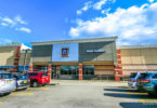
Califon, NJ is a very quaint, peaceful town to the north of Route 22. Despite being in the bottom 10% of both population and size, it’s not a ghost town, as two fairly major county roads (CR 512 and CR 513) travel through. A nice place to stop in every now and then!
Califon, New Jersey
Califon is a borough in Hunterdon County, New Jersey, United States. As of the 2010 United States Census, the borough’s population was 1,076, reflecting an increase of 21 (+2.0%) from the 1,055 counted in the 2000 Census, which had in turn declined by 18 (-1.7%) from the 1,073 counted in the 1990 Census.
The town was to originally have been called California, but the name was shortened to Califon in order to fit on the welcome sign. Alternatively, the name was related to a bright yellow cattle feed sold during the Gold Rush.
History

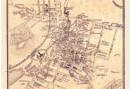
Califon, NJ – wider view perspective.
Califon was a station on the High Bridge Branch of the Central Railroad of New Jersey. The rail line was abandoned in 1976 and now serves as a Hunterdon County-administered rail trail called Columbia Trail, which runs south to High Bridge and north to points in Morris County.
Though the mills were present in the area of Califon for some time prior to its incorporation as a town, it was quite a while before growth became evident in the mid-nineteenth century. It was first called California, from Jacob Neighbor’s enthusiasm in the milling business about the time the California Gold Rush broke out. The Borough was incorporated by an act of the New Jersey Legislature from portions of both Lebanon and Tewksbury Townships on April 2, 1918.
Local legend has it that California became a regular stop for weekend excursion trains through the countryside. When riders bought their tickets they were issued a voucher good for an ice cream; the train would stop so tourists could wander around and cash in their ice cream coupons. Anxious to exploit this source of outside revenue, residents petitioned the railroad to let them build a real station, which they did as a community project. Citing the local account again, two sign painters who came to letter the sign rode the train from Dunellen, but the background paint wasn’t dry when they arrived. They sat and drank at the hotel, which later burned down. By the time the sign was ready for their artistic touch, the local tale says, “Califon” was as close to California as the inebriated painters could manage.
Califon is situated just north of the Ken Lockwood Gorge on the South Branch of the Raritan River; this pristine stretch of clear water and forest is a well-known treasure for New Jersey trout fishermen.
The Califon Historic District is a 164-acre (66 ha) historic district that was listed on the National Register of Historic Places in 1976. It included 154 contributing buildings, three contributing structures, and one contributing site, created through the efforts of the Califon Historical Society. Califon is a Victorian-style enclave where the houses are marked with the names of the builders and their dates of the establishment rather than with street numbers.
The center of Califon is the historic iron bridge spanning the South Branch of the Raritan River, which divides the borough. Recently the State of New Jersey announced that the bridge would be replaced because a loaded school bus represented more weight than the aging bridge could safely carry. Incensed citizens objected, protective of the landmark, and found a colorful but simple solution; the school bus stops at one end of the bridge unloading the students, who then walk across to the other side. Then the empty bus, within imposed weight limits, drives across and the students get back on the bus to continue their ride. Thus the bridge was saved. (Account featured on Califon website).
Califon became a regional household name when frequently mentioned by Merv Griffin on his TV show during the 1970s. He and his wife Juliette owned a home in nearby Lebanon Township, which had a Califon mailing address, and, while they were married, they were often seen visiting the village in a fringed-top Bermuda-style resort cart. Califon Productions created all of his television ventures.
The Hoffmans were a family of German farmers who to this day are remembered by the bridge and section south of Califon known as Hoffman’s Crossing. Thomas B. Hoffman farmed land that lies just south of Califon Bridge, along present-day Route 513.
Geography
According to the United States Census Bureau, the borough had a total area of 0.972 square miles (2.518 km), including 0.949 square miles (2.459 km) of land and 0.023 square miles (0.059 km) of water (2.36%).
Califon borders the Hunterdon County municipalities of Lebanon Township and Tewksbury Township.
Lower Valley is an unincorporated community located along the border of Califon and Lebanon Township.
Demographics
| Historical population | |||
|---|---|---|---|
| Census | Pop. | %± | |
| 1920 | 513 | — | |
| 1930 | 534 | 4.1% | |
| 1940 | 572 | 7.1% | |
| 1950 | 623 | 8.9% | |
| 1960 | 777 | 24.7% | |
| 1970 | 970 | 24.8% | |
| 1980 | 1,023 | 5.5% | |
| 1990 | 1,073 | 4.9% | |
| 2000 | 1,055 | −1.7% | |
| 2010 | 1,076 | 2.0% | |
| Est. 2014 | 1,087 | 1.0% | |
Census 2010
At the 2010 United States Census, there were 1,076 people, 394 households, and 308.9 families residing in the borough. The population density was 1,133.3 per square mile (437.6/km). There were 419 housing units at an average density of 441.3 per square mile (170.4/km). The racial makeup of the borough was 96.10% (1,034) White, 0.28% (3) Black or African American, 0.09% (1) Native American, 0.84% (9) Asian, 0.00% (0) Pacific Islander, 0.09% (1) from other races, and 2.60% (28) from two or more races. Hispanics or Latinos of any race were 1.30% (14) of the population.
There were 394 households, of which 40.1% had children under the age of 18 living with them, 67.8% were married couples living together, 7.6% had a female householder with no husband present, and 21.6% were non-families. 17.8% of all households were made up of individuals, and 5.6% had someone living alone who was 65 years of age or older. The average household size was 2.73 and the average family size was 3.14.
In the borough, 28.2% of the population were under the age of 18, 4.8% from 18 to 24, 22.6% from 25 to 44, 34.9% from 45 to 64, and 9.6% who were 65 years of age or older. The median age was 41.9 years. For every 100 females there were 93.5 males. For every 100 females age 18 and over, there were 88.5 males.
The Census Bureau’s 2006-2010 American Community Survey showed that (in 2010 inflation-adjusted dollars) median household income was $108,375 (with a margin of error of +/- $9,026) and the median family income was $110,365 (+/- $5,782). Males had a median income of $95,536 (+/- $13,555) versus $73,958 (+/- $14,845) for females. The per capita income for the borough was $42,975 (+/- $5,250). About 1.7% of families and 2.4% of the population were below the poverty line, including 0.8% of those under age 18 and 0.0% of those age 65 or over.
Transportation
As of May 2010, the borough had a total of 11.50 miles (18.51 km) of roadways, of which 9.50 miles (15.29 km) were maintained by the municipality and 2.00 miles (3.22 km) by Hunterdon County.
Notable people
People who were born in, residents of, or otherwise closely associated with Califon include:
- Thomas W. Greelish (1939–1991), United States Attorney for the District of New Jersey from 1985 to 1987. Greelish moved to Califon with his family when he was seven years old.
- Merv Griffin (1925–2007), television producer, once owned a farm a few miles outside of Califon. When he created the game show Wheel of Fortune, he gave a nod to Califon when naming the show’s production company. To this day, Califon Productions, Inc. is the copyright holder for all episodes of Wheel of Fortune to date, although the show is owned by Sony Pictures Television.
- Francis Burton Harrison (1873–1957), member of the United States House of Representatives and Governor-General of the Philippines under Woodrow Wilson who retired to Califon a few months before his death in 1957.
- Teddy Schneider (born 1988), soccer player for the New York Red Bulls.